LSZ Lusaka, Zambia - Earthquake Result Viewer
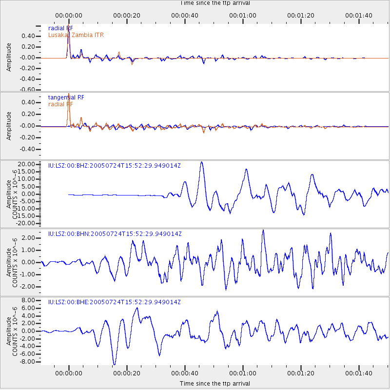
Earthquake location: Nicobar Islands, India Region
Earthquake latitude/longitude: 7.9/92.2
Earthquake time(UTC): 2005/07/24 (205) 15:42:06 GMT
Earthquake Depth: 16 km
Earthquake Magnitude: 6.6 MB, 7.5 MS, 7.3 MW, 7.2 MW
Earthquake Catalog/Contributor: WHDF/NEIC
Network: IU Global Seismograph Network (GSN - IRIS/USGS)
Station: LSZ Lusaka, Zambia
Lat/Lon: 15.28 S/28.19 E
Elevation: 1184 m
Distance: 67.5 deg
Az: 249.909 deg
Baz: 74.566 deg
Ray Param: 0.056925606
Estimated Moho Depth: 39.5 km
Estimated Crust Vp/Vs: 1.68
Assumed Crust Vp: 6.642 km/s
Estimated Crust Vs: 3.965 km/s
Estimated Crust Poisson's Ratio: 0.22
Radial Match: 97.93722 %
Radial Bump: 287
Transverse Match: 89.41199 %
Transverse Bump: 400
SOD ConfigId: 2475
Insert Time: 2010-03-02 15:24:51.404 +0000
GWidth: 2.5
Max Bumps: 400
Tol: 0.001

Signal To Noise

ChannelStoNSTALTA
IU:LSZ:00:BHN:20050724T15:52:29.949014Z1.27834141.5919726E-71.2453424E-7
IU:LSZ:00:BHE:20050724T15:52:29.949014Z4.29137565.58218E-71.3007904E-7
IU:LSZ:00:BHZ:20050724T15:52:29.949014Z6.05078659.6314E-71.59176E-7
Arrivals
Ps4.2 SECOND
PpPs15 SECOND
PsPs/PpSs19 SECOND