LSZ Lusaka, Zambia - Earthquake Result Viewer
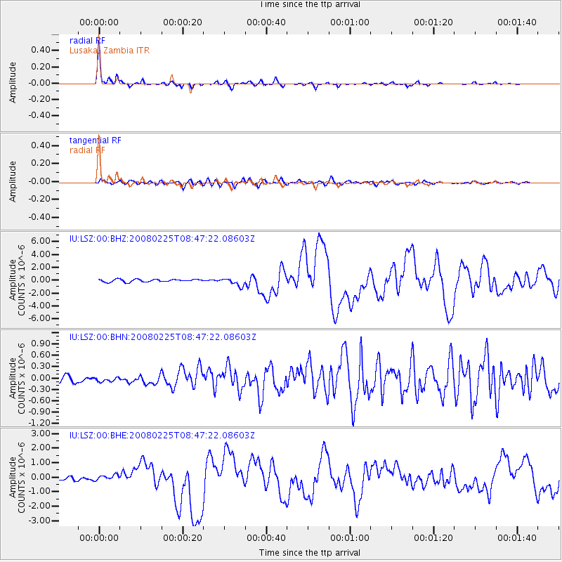
Earthquake location: Southern Sumatra, Indonesia
Earthquake latitude/longitude: -2.5/100.0
Earthquake time(UTC): 2008/02/25 (056) 08:36:33 GMT
Earthquake Depth: 25 km
Earthquake Magnitude: 6.4 MB, 7.3 MS, 7.0 MW, 6.9 MW
Earthquake Catalog/Contributor: WHDF/NEIC
Network: IU Global Seismograph Network (GSN - IRIS/USGS)
Station: LSZ Lusaka, Zambia
Lat/Lon: 15.28 S/28.19 E
Elevation: 1184 m
Distance: 71.8 deg
Az: 254.828 deg
Baz: 87.575 deg
Ray Param: 0.05406967
Estimated Moho Depth: 39.5 km
Estimated Crust Vp/Vs: 1.71
Assumed Crust Vp: 6.642 km/s
Estimated Crust Vs: 3.878 km/s
Estimated Crust Poisson's Ratio: 0.24
Radial Match: 97.4666 %
Radial Bump: 241
Transverse Match: 84.24717 %
Transverse Bump: 400
SOD ConfigId: 2564
Insert Time: 2010-03-02 15:25:38.976 +0000
GWidth: 2.5
Max Bumps: 400
Tol: 0.001

Signal To Noise

ChannelStoNSTALTA
IU:LSZ:00:BHN:20080225T08:47:22.08603Z0.404410247.218229E-81.7848778E-7
IU:LSZ:00:BHE:20080225T08:47:22.08603Z1.98132511.9019794E-79.599532E-8
IU:LSZ:00:BHZ:20080225T08:47:22.08603Z2.98914986.071722E-72.0312537E-7
Arrivals
Ps4.4 SECOND
PpPs16 SECOND
PsPs/PpSs20 SECOND