
OSI Osito Audit - Earthquake Result Viewer

| ||||||||||||||||||
| ||||||||||||||||||
| ||||||||||||||||||
|
Signal To Noise
| Channel | StoN | STA | LTA |
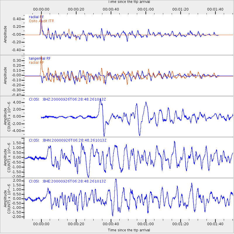
| CI:OSI: :BHN:20000926T06:28:48.261013Z | 4.0552263 | 4.8333334E-7 | 1.1918775E-7 |
| CI:OSI: :BHE:20000926T06:28:48.261013Z | 3.9234638 | 5.2557317E-7 | 1.3395642E-7 |
| CI:OSI: :BHZ:20000926T06:28:48.261013Z | 12.681395 | 2.2133531E-6 | 1.7453547E-7 |
| Arrivals | |
| Ps | 8.2 SECOND |
| PpPs | 24 SECOND |
| PsPs/PpSs | 32 SECOND |

