
LSZ Lusaka, Zambia - Earthquake Result Viewer
| ||||||||||||||||||
| ||||||||||||||||||
| ||||||||||||||||||
|
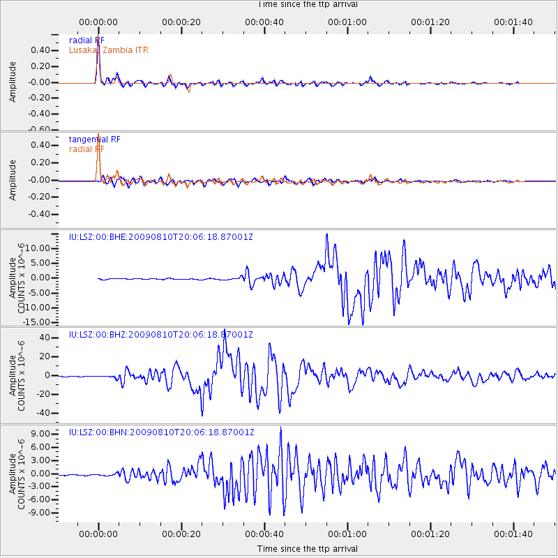
Signal To Noise
| Channel | StoN | STA | LTA |
| IU:LSZ:00:BHZ:20090810T20:06:18.87001Z | 4.851314 | 1.2055638E-6 | 2.4850254E-7 |
| IU:LSZ:00:BHN:20090810T20:06:18.87001Z | 1.5363328 | 2.4150302E-7 | 1.5719446E-7 |
| IU:LSZ:00:BHE:20090810T20:06:18.87001Z | 3.1421812 | 4.6619508E-7 | 1.4836671E-7 |
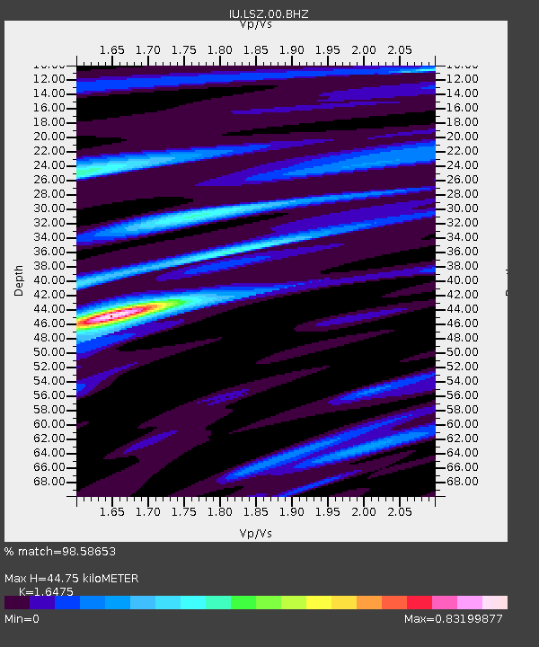
| Arrivals | |
| Ps | 4.6 SECOND |
| PpPs | 17 SECOND |
| PsPs/PpSs | 22 SECOND |

