
LSZ Lusaka, Zambia - Earthquake Result Viewer
| ||||||||||||||||||
| ||||||||||||||||||
| ||||||||||||||||||
|
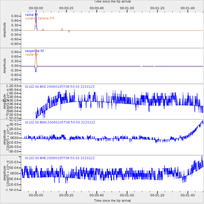
Signal To Noise
| Channel | StoN | STA | LTA |
| IU:LSZ:00:BHN:20060105T08:50:03.322012Z | 0.80296105 | 3.1930966E-10 | 3.976652E-10 |
| IU:LSZ:00:BHE:20060105T08:50:03.322012Z | 0.8411532 | 2.9987762E-10 | 3.565077E-10 |
| IU:LSZ:00:BHZ:20060105T08:50:03.322012Z | 0.57289237 | 3.1902145E-10 | 5.5686106E-10 |
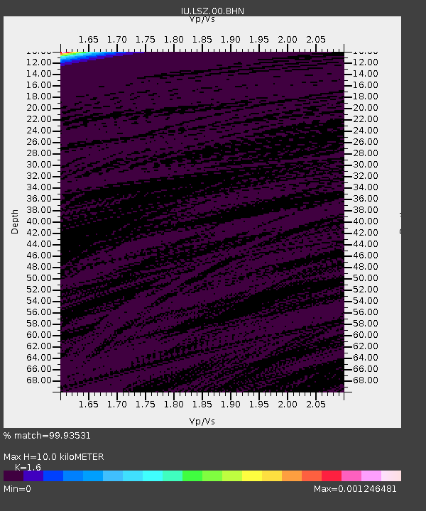
| Arrivals | |
| Ps | 1.0 SECOND |
| PpPs | 3.7 SECOND |
| PsPs/PpSs | 4.6 SECOND |

