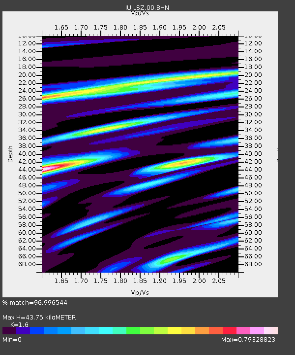
LSZ Lusaka, Zambia - Earthquake Result Viewer
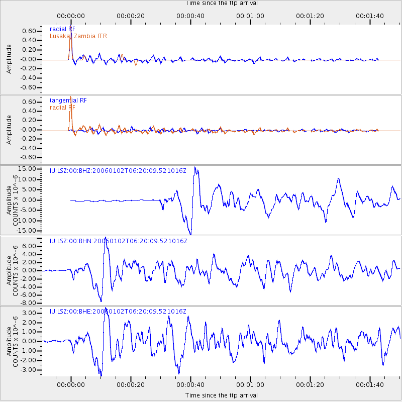
Earthquake location: Southwestern Atlantic Ocean
Earthquake latitude/longitude: -60.9/-21.6
Earthquake time(UTC): 2006/01/02 (002) 06:10:49 GMT
Earthquake Depth: 10 km
Earthquake Magnitude: 6.4 MB, 7.3 MS, 7.4 MW, 7.1 MW
Earthquake Catalog/Contributor: WHDF/NEIC
Network: IU Global Seismograph Network (GSN - IRIS/USGS)
Station: LSZ Lusaka, Zambia
Lat/Lon: 15.28 S/28.19 E
Elevation: 1184 m
Distance: 57.8 deg
Az: 60.539 deg
Baz: 206.138 deg
Ray Param: 0.06326187
Estimated Moho Depth: 43.75 km
Estimated Crust Vp/Vs: 1.60
Assumed Crust Vp: 6.642 km/s
Estimated Crust Vs: 4.151 km/s
Estimated Crust Poisson's Ratio: 0.18
Radial Match: 96.996544 %
Radial Bump: 341
Transverse Match: 84.9288 %
Transverse Bump: 400
SOD ConfigId: 4977
Insert Time: 2010-03-02 15:27:18.636 +0000
GWidth: 2.5
Max Bumps: 400
Tol: 0.001

Signal To Noise

ChannelStoNSTALTA
IU:LSZ:00:BHN:20060102T06:20:09.521016Z8.79336557.7369725E-78.7986486E-8
IU:LSZ:00:BHE:20060102T06:20:09.521016Z5.9583784.2224372E-77.0865546E-8
IU:LSZ:00:BHZ:20060102T06:20:09.521016Z7.0812341.5268823E-62.1562377E-7
Arrivals
Ps4.2 SECOND
PpPs16 SECOND
PsPs/PpSs20 SECOND