
KEV Kevo, Finland - Earthquake Result Viewer
| ||||||||||||||||||
| ||||||||||||||||||
| ||||||||||||||||||
|
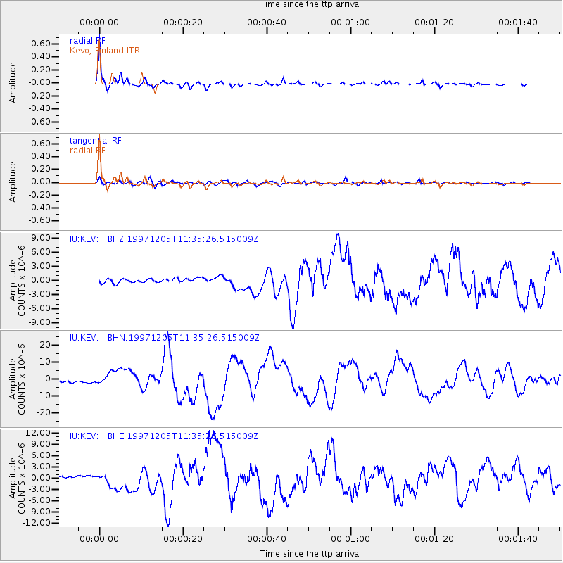
Signal To Noise
| Channel | StoN | STA | LTA |
| IU:KEV: :BHN:19971205T11:35:26.515009Z | 6.361252 | 4.3768896E-6 | 6.8805474E-7 |
| IU:KEV: :BHE:19971205T11:35:26.515009Z | 4.5790453 | 1.9877727E-6 | 4.34102E-7 |
| IU:KEV: :BHZ:19971205T11:35:26.515009Z | 3.3738692 | 1.4676579E-6 | 4.3500734E-7 |
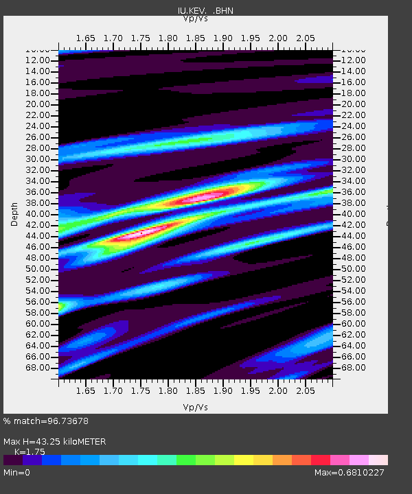
| Arrivals | |
| Ps | 5.2 SECOND |
| PpPs | 17 SECOND |
| PsPs/PpSs | 22 SECOND |

