KEV Kevo, Finland - Earthquake Result Viewer
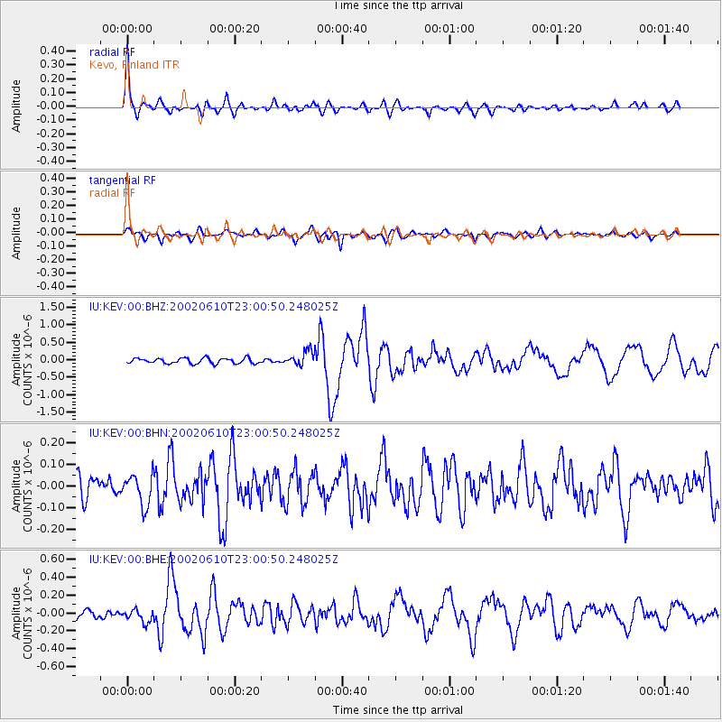
Earthquake location: W. Caroline Islands, Micronesia
Earthquake latitude/longitude: 11.0/140.7
Earthquake time(UTC): 2002/06/10 (161) 22:48:36 GMT
Earthquake Depth: 33 km
Earthquake Magnitude: 5.9 MB, 5.9 MS, 6.1 MW, 6.0 MW
Earthquake Catalog/Contributor: WHDF/NEIC
Network: IU Global Seismograph Network (GSN - IRIS/USGS)
Station: KEV Kevo, Finland
Lat/Lon: 69.76 N/27.01 E
Elevation: 80 m
Distance: 87.7 deg
Az: 341.396 deg
Baz: 64.151 deg
Ray Param: 0.04309494
Estimated Moho Depth: 43.75 km
Estimated Crust Vp/Vs: 1.86
Assumed Crust Vp: 6.622 km/s
Estimated Crust Vs: 3.565 km/s
Estimated Crust Poisson's Ratio: 0.30
Radial Match: 93.03476 %
Radial Bump: 400
Transverse Match: 77.75415 %
Transverse Bump: 400
SOD ConfigId: 20082
Insert Time: 2010-03-02 15:29:40.603 +0000
GWidth: 2.5
Max Bumps: 400
Tol: 0.001

Signal To Noise

ChannelStoNSTALTA
IU:KEV:00:BHN:20020610T23:00:50.248025Z1.62858517.1322816E-84.3794344E-8
IU:KEV:00:BHE:20020610T23:00:50.248025Z1.73387757.219721E-84.1639165E-8
IU:KEV:00:BHZ:20020610T23:00:50.248025Z2.65581152.0482761E-77.71243E-8
Arrivals
Ps5.8 SECOND
PpPs18 SECOND
PsPs/PpSs24 SECOND