You are here: Home > Network List > TA - USArray Transportable Network (new EarthScope stations) Stations List
> Station MSTX Muleshoe, TX, USA > Earthquake Result Viewer
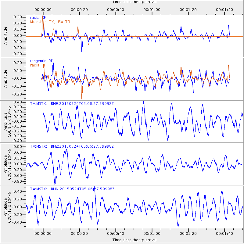
MSTX Muleshoe, TX, USA - Earthquake Result Viewer
*The percent match for this event was below the threshold and hence no stack was calculated.
| Earthquake location: |
Southern Mid-Atlantic Ridge |
| Earthquake latitude/longitude: |
-16.8/-14.2 |
| Earthquake time(UTC): |
2015/05/24 (144) 04:53:22 GMT |
| Earthquake Depth: |
10 km |
| Earthquake Magnitude: |
6.3 MWP |
| Earthquake Catalog/Contributor: |
NEIC PDE/NEIC COMCAT |
|
| Network: |
TA USArray Transportable Network (new EarthScope stations) |
| Station: |
MSTX Muleshoe, TX, USA |
| Lat/Lon: |
33.97 N/102.77 W |
| Elevation: |
1167 m |
|
| Distance: |
98.1 deg |
| Az: |
302.952 deg |
| Baz: |
104.762 deg |
| Ray Param: |
$rayparam |
*The percent match for this event was below the threshold and hence was not used in the summary stack. |
|
| Radial Match: |
49.383877 % |
| Radial Bump: |
400 |
| Transverse Match: |
60.85709 % |
| Transverse Bump: |
343 |
| SOD ConfigId: |
7422571 |
| Insert Time: |
2019-04-19 01:08:14.235 +0000 |
| GWidth: |
2.5 |
| Max Bumps: |
400 |
| Tol: |
0.001 |
|
Signal To Noise
| Channel | StoN | STA | LTA |
| TA:MSTX: :BHZ:20150524T05:06:27.59998Z | 2.9295878 | 2.9136692E-7 | 9.945662E-8 |
| TA:MSTX: :BHN:20150524T05:06:27.59998Z | 1.9111893 | 1.7477902E-7 | 9.145039E-8 |
| TA:MSTX: :BHE:20150524T05:06:27.59998Z | 0.65101606 | 1.0247483E-7 | 1.5740754E-7 |
| Arrivals |
| Ps | |
| PpPs | |
| PsPs/PpSs | |


