You are here: Home > Network List > TA - USArray Transportable Network (new EarthScope stations) Stations List
> Station O56A Blue Knob State Park, Imler, PA, USA > Earthquake Result Viewer
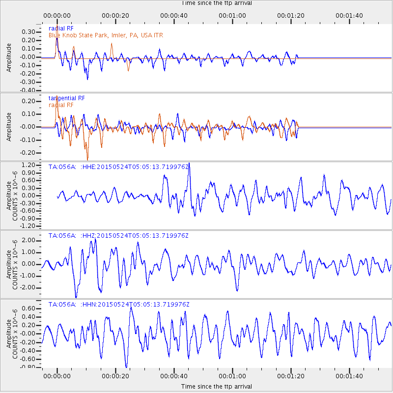
O56A Blue Knob State Park, Imler, PA, USA - Earthquake Result Viewer
*The percent match for this event was below the threshold and hence no stack was calculated.
| Earthquake location: |
Southern Mid-Atlantic Ridge |
| Earthquake latitude/longitude: |
-16.8/-14.2 |
| Earthquake time(UTC): |
2015/05/24 (144) 04:53:22 GMT |
| Earthquake Depth: |
10 km |
| Earthquake Magnitude: |
6.3 MWP |
| Earthquake Catalog/Contributor: |
NEIC PDE/NEIC COMCAT |
|
| Network: |
TA USArray Transportable Network (new EarthScope stations) |
| Station: |
O56A Blue Knob State Park, Imler, PA, USA |
| Lat/Lon: |
40.27 N/78.57 W |
| Elevation: |
684 m |
|
| Distance: |
82.4 deg |
| Az: |
315.894 deg |
| Baz: |
119.411 deg |
| Ray Param: |
$rayparam |
*The percent match for this event was below the threshold and hence was not used in the summary stack. |
|
| Radial Match: |
67.78665 % |
| Radial Bump: |
328 |
| Transverse Match: |
68.345146 % |
| Transverse Bump: |
383 |
| SOD ConfigId: |
7422571 |
| Insert Time: |
2019-04-19 01:08:18.892 +0000 |
| GWidth: |
2.5 |
| Max Bumps: |
400 |
| Tol: |
0.001 |
|
Signal To Noise
| Channel | StoN | STA | LTA |
| TA:O56A: :HHZ:20150524T05:05:13.719976Z | 4.0917473 | 5.562179E-7 | 1.3593653E-7 |
| TA:O56A: :HHN:20150524T05:05:13.719976Z | 0.9282025 | 1.5750504E-7 | 1.6968824E-7 |
| TA:O56A: :HHE:20150524T05:05:13.719976Z | 0.86110574 | 1.2199591E-7 | 1.4167355E-7 |
| Arrivals |
| Ps | |
| PpPs | |
| PsPs/PpSs | |


