
KEV Kevo, Finland - Earthquake Result Viewer
| ||||||||||||||||||
| ||||||||||||||||||
| ||||||||||||||||||
|
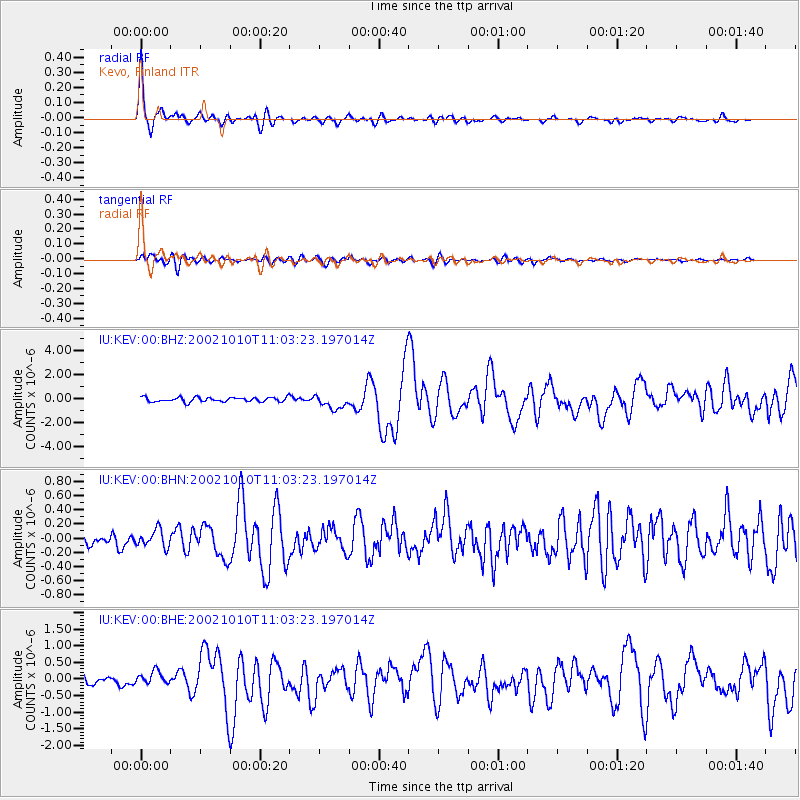
Signal To Noise
| Channel | StoN | STA | LTA |
| IU:KEV:00:BHN:20021010T11:03:23.197014Z | 1.1946291 | 1.1953664E-7 | 1.0006171E-7 |
| IU:KEV:00:BHE:20021010T11:03:23.197014Z | 1.8466126 | 2.0574095E-7 | 1.11415325E-7 |
| IU:KEV:00:BHZ:20021010T11:03:23.197014Z | 3.1485066 | 5.9610176E-7 | 1.8932842E-7 |
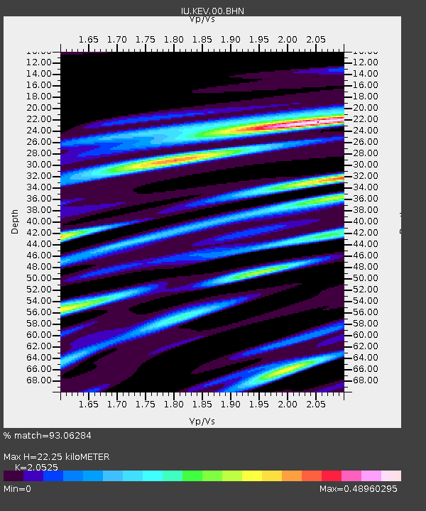
| Arrivals | |
| Ps | 3.6 SECOND |
| PpPs | 10 SECOND |
| PsPs/PpSs | 14 SECOND |

