
KEV Kevo, Finland - Earthquake Result Viewer
| ||||||||||||||||||
| ||||||||||||||||||
| ||||||||||||||||||
|
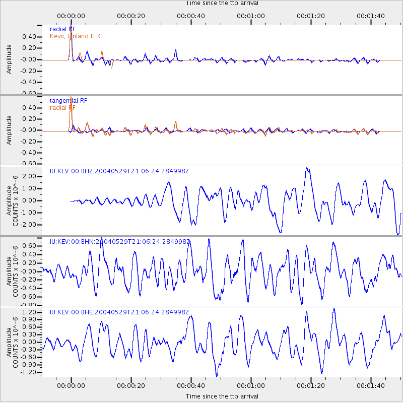
Signal To Noise
| Channel | StoN | STA | LTA |
| IU:KEV:00:BHN:20040529T21:06:24.284998Z | 1.5836538 | 1.6692398E-7 | 1.0540434E-7 |
| IU:KEV:00:BHE:20040529T21:06:24.284998Z | 2.8169425 | 3.4476426E-7 | 1.2238952E-7 |
| IU:KEV:00:BHZ:20040529T21:06:24.284998Z | 5.0238953 | 8.833514E-7 | 1.7582997E-7 |
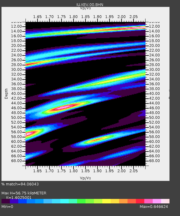
| Arrivals | |
| Ps | 5.4 SECOND |
| PpPs | 21 SECOND |
| PsPs/PpSs | 27 SECOND |

