
OSI Osito Audit - Earthquake Result Viewer
| ||||||||||||||||||
| ||||||||||||||||||
| ||||||||||||||||||
|
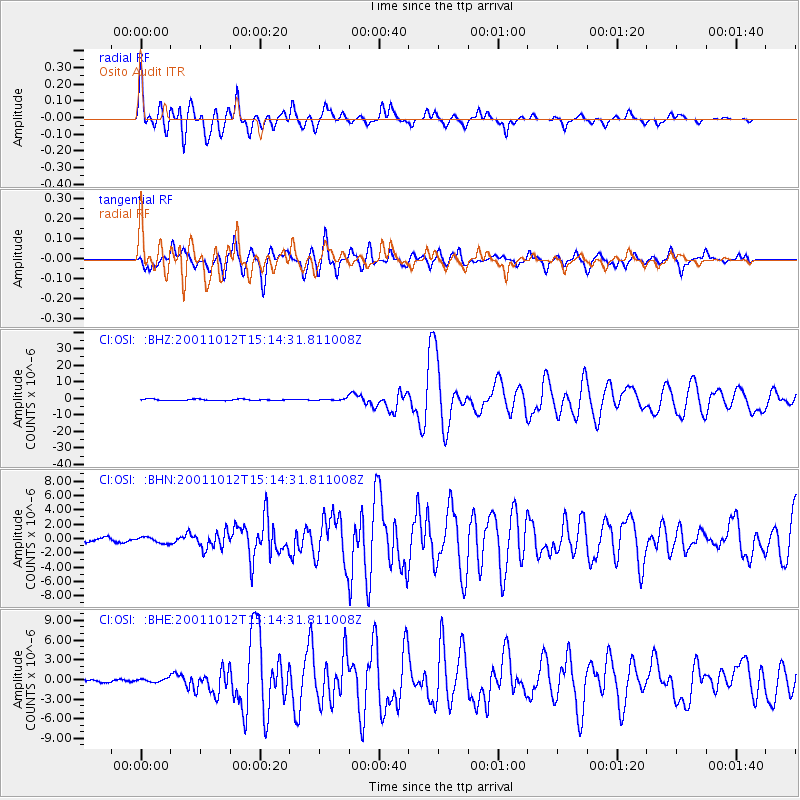
Signal To Noise
| Channel | StoN | STA | LTA |
| CI:OSI: :BHN:20011012T15:14:31.811008Z | 2.3186436 | 4.133431E-7 | 1.7826936E-7 |
| CI:OSI: :BHE:20011012T15:14:31.811008Z | 0.90048814 | 2.8555448E-7 | 3.1711076E-7 |
| CI:OSI: :BHZ:20011012T15:14:31.811008Z | 1.5352095 | 6.3500096E-7 | 4.1362492E-7 |
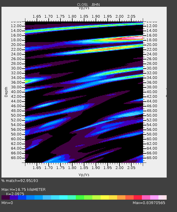
| Arrivals | |
| Ps | 3.1 SECOND |
| PpPs | 8.4 SECOND |
| PsPs/PpSs | 11 SECOND |

