
KEV Kevo, Finland - Earthquake Result Viewer
| ||||||||||||||||||
| ||||||||||||||||||
| ||||||||||||||||||
|
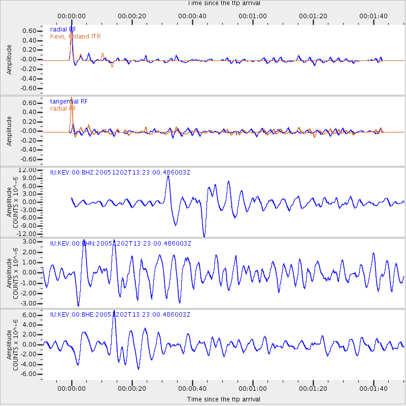
Signal To Noise
| Channel | StoN | STA | LTA |
| IU:KEV:00:BHN:20051202T13:23:00.486003Z | 2.670676 | 1.8080722E-6 | 6.770092E-7 |
| IU:KEV:00:BHE:20051202T13:23:00.486003Z | 5.4453535 | 2.2117563E-6 | 4.0617314E-7 |
| IU:KEV:00:BHZ:20051202T13:23:00.486003Z | 7.1831937 | 5.537182E-6 | 7.7085235E-7 |
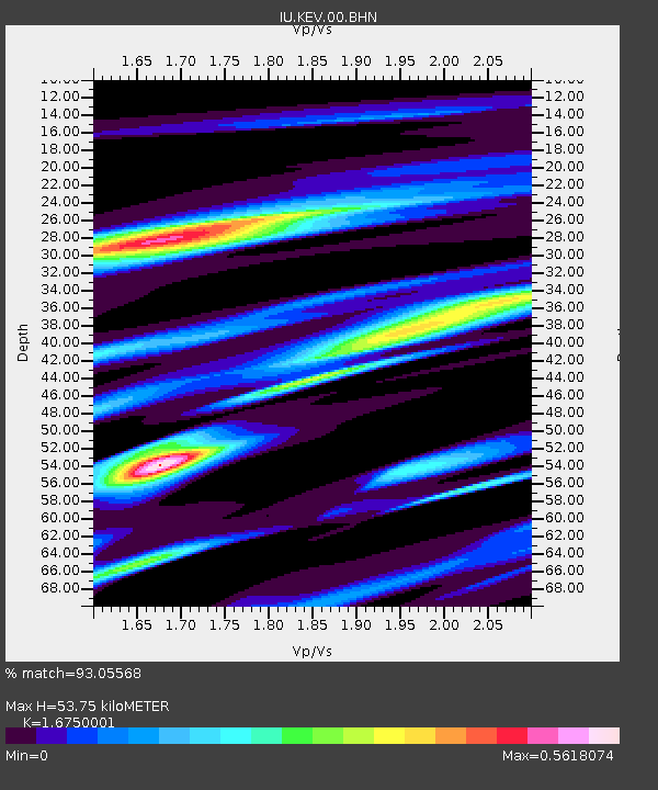
| Arrivals | |
| Ps | 5.8 SECOND |
| PpPs | 21 SECOND |
| PsPs/PpSs | 26 SECOND |

