You are here: Home > Network List > AV - Alaska Volcano Observatory Stations List
> Station MAPS Pakushin Southeast, Makushin Volcano, Alaska > Earthquake Result Viewer
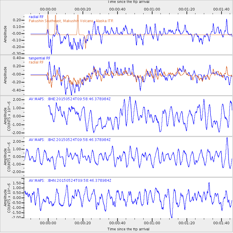
MAPS Pakushin Southeast, Makushin Volcano, Alaska - Earthquake Result Viewer
*The percent match for this event was below the threshold and hence no stack was calculated.
| Earthquake location: |
South Of Tonga Islands |
| Earthquake latitude/longitude: |
-24.1/-174.6 |
| Earthquake time(UTC): |
2015/05/24 (144) 09:47:20 GMT |
| Earthquake Depth: |
10 km |
| Earthquake Magnitude: |
4.8 mb, 4.7 mb, 3.4 MS |
| Earthquake Catalog/Contributor: |
ISC/ISC |
|
| Network: |
AV Alaska Volcano Observatory |
| Station: |
MAPS Pakushin Southeast, Makushin Volcano, Alaska |
| Lat/Lon: |
53.81 N/166.94 W |
| Elevation: |
333 m |
|
| Distance: |
77.8 deg |
| Az: |
4.649 deg |
| Baz: |
187.176 deg |
| Ray Param: |
$rayparam |
*The percent match for this event was below the threshold and hence was not used in the summary stack. |
|
| Radial Match: |
52.57993 % |
| Radial Bump: |
400 |
| Transverse Match: |
55.565323 % |
| Transverse Bump: |
400 |
| SOD ConfigId: |
7422571 |
| Insert Time: |
2019-04-19 01:12:02.985 +0000 |
| GWidth: |
2.5 |
| Max Bumps: |
400 |
| Tol: |
0.001 |
|
Signal To Noise
| Channel | StoN | STA | LTA |
| AV:MAPS: :BHZ:20150524T09:58:46.378984Z | 1.0744056 | 7.3503287E-7 | 6.841298E-7 |
| AV:MAPS: :BHN:20150524T09:58:46.378984Z | 0.92474556 | 5.772599E-7 | 6.2423646E-7 |
| AV:MAPS: :BHE:20150524T09:58:46.378984Z | 1.6481203 | 1.1949402E-6 | 7.250322E-7 |
| Arrivals |
| Ps | |
| PpPs | |
| PsPs/PpSs | |


