You are here: Home > Network List > GS - US Geological Survey Networks Stations List
> Station KAN13 Rinehart Farm > Earthquake Result Viewer
KAN13 Rinehart Farm - Earthquake Result Viewer
*The percent match for this event was below the threshold and hence no stack was calculated.
| Earthquake location: |
South Of Tonga Islands |
| Earthquake latitude/longitude: |
-24.1/-174.6 |
| Earthquake time(UTC): |
2015/05/24 (144) 09:47:20 GMT |
| Earthquake Depth: |
10 km |
| Earthquake Magnitude: |
4.8 mb, 4.7 mb, 3.4 MS |
| Earthquake Catalog/Contributor: |
ISC/ISC |
|
| Network: |
GS US Geological Survey Networks |
| Station: |
KAN13 Rinehart Farm |
| Lat/Lon: |
37.01 N/97.48 W |
| Elevation: |
340 m |
|
| Distance: |
94.6 deg |
| Az: |
51.526 deg |
| Baz: |
243.381 deg |
| Ray Param: |
$rayparam |
*The percent match for this event was below the threshold and hence was not used in the summary stack. |
|
| Radial Match: |
46.47283 % |
| Radial Bump: |
400 |
| Transverse Match: |
57.7594 % |
| Transverse Bump: |
400 |
| SOD ConfigId: |
7422571 |
| Insert Time: |
2019-04-19 01:13:35.431 +0000 |
| GWidth: |
2.5 |
| Max Bumps: |
400 |
| Tol: |
0.001 |
|
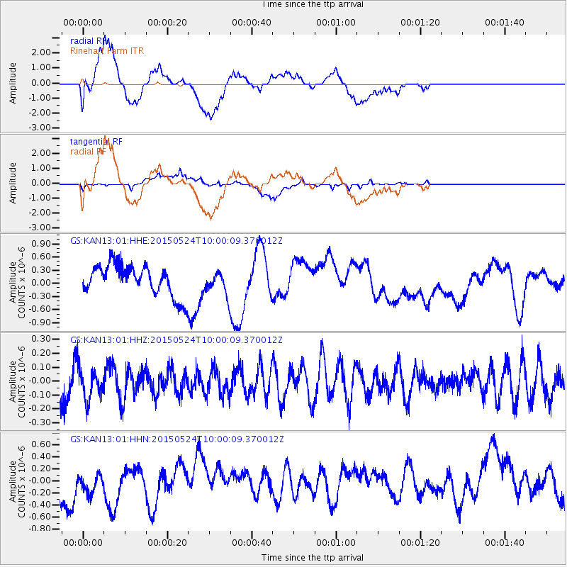
Signal To Noise
| Channel | StoN | STA | LTA |
| GS:KAN13:01:HHZ:20150524T10:00:09.370012Z | 0.5969351 | 1.03776465E-7 | 1.7384882E-7 |
| GS:KAN13:01:HHN:20150524T10:00:09.370012Z | 0.94961 | 2.5178855E-7 | 2.6514945E-7 |
| GS:KAN13:01:HHE:20150524T10:00:09.370012Z | 0.7637575 | 2.6412573E-7 | 3.4582405E-7 |
| Arrivals |
| Ps | |
| PpPs | |
| PsPs/PpSs | |


