KEV Kevo, Finland - Earthquake Result Viewer
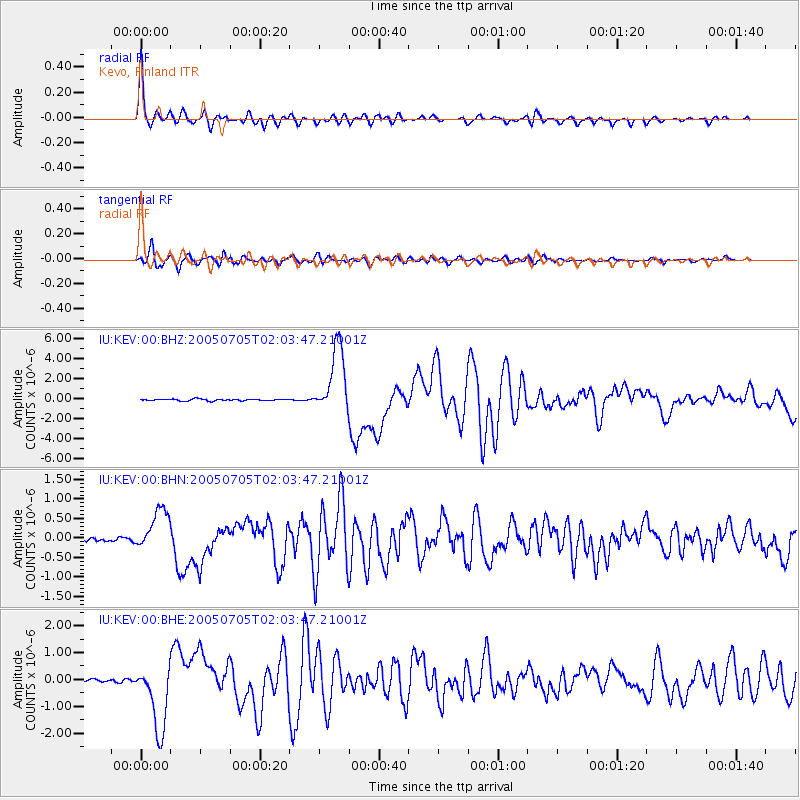
Earthquake location: Northern Sumatra, Indonesia
Earthquake latitude/longitude: 1.8/97.1
Earthquake time(UTC): 2005/07/05 (186) 01:52:02 GMT
Earthquake Depth: 21 km
Earthquake Magnitude: 6.2 MB, 6.8 MS, 6.7 MW, 6.6 MW
Earthquake Catalog/Contributor: WHDF/NEIC
Network: IU Global Seismograph Network (GSN - IRIS/USGS)
Station: KEV Kevo, Finland
Lat/Lon: 69.76 N/27.01 E
Elevation: 80 m
Distance: 81.5 deg
Az: 340.677 deg
Baz: 108.166 deg
Ray Param: 0.04753541
Estimated Moho Depth: 46.5 km
Estimated Crust Vp/Vs: 1.67
Assumed Crust Vp: 6.622 km/s
Estimated Crust Vs: 3.959 km/s
Estimated Crust Poisson's Ratio: 0.22
Radial Match: 97.524536 %
Radial Bump: 400
Transverse Match: 95.03559 %
Transverse Bump: 400
SOD ConfigId: 2475
Insert Time: 2010-03-02 15:30:47.880 +0000
GWidth: 2.5
Max Bumps: 400
Tol: 0.001

Signal To Noise

ChannelStoNSTALTA
IU:KEV:00:BHN:20050705T02:03:47.21001Z11.2418355.381078E-74.786655E-8
IU:KEV:00:BHE:20050705T02:03:47.21001Z26.9977991.2579544E-64.65947E-8
IU:KEV:00:BHZ:20050705T02:03:47.21001Z41.1553653.400732E-68.263156E-8
Arrivals
Ps4.9 SECOND
PpPs18 SECOND
PsPs/PpSs23 SECOND