
KEV Kevo, Finland - Earthquake Result Viewer
| ||||||||||||||||||
| ||||||||||||||||||
| ||||||||||||||||||
|
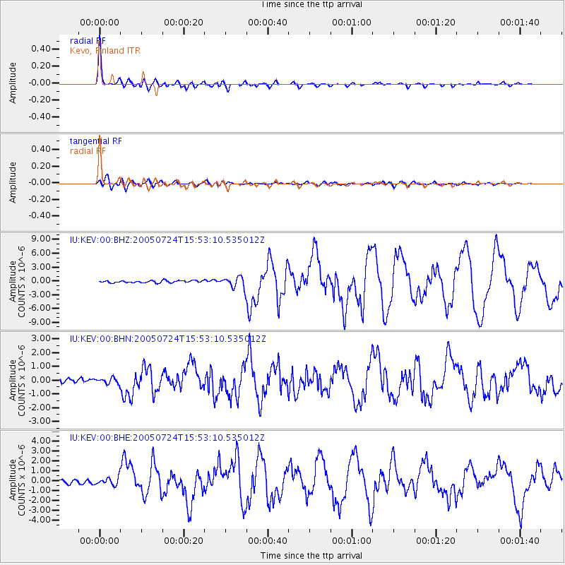
Signal To Noise
| Channel | StoN | STA | LTA |
| IU:KEV:00:BHN:20050724T15:53:10.535012Z | 1.5725821 | 2.1320366E-7 | 1.3557553E-7 |
| IU:KEV:00:BHE:20050724T15:53:10.535012Z | 1.6640502 | 4.2596025E-7 | 2.55978E-7 |
| IU:KEV:00:BHZ:20050724T15:53:10.535012Z | 5.7162857 | 1.282024E-6 | 2.2427568E-7 |
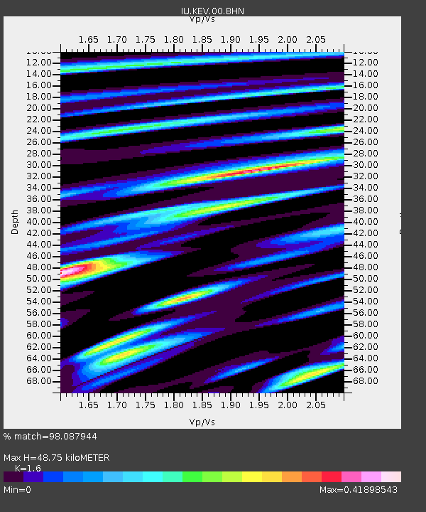
| Arrivals | |
| Ps | 4.6 SECOND |
| PpPs | 18 SECOND |
| PsPs/PpSs | 23 SECOND |

