
KEV Kevo, Finland - Earthquake Result Viewer
| ||||||||||||||||||
| ||||||||||||||||||
| ||||||||||||||||||
|
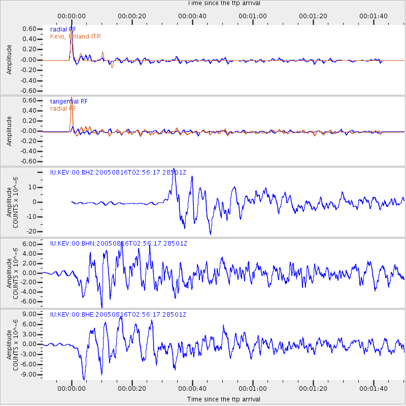
Signal To Noise
| Channel | StoN | STA | LTA |
| IU:KEV:00:BHN:20050816T02:56:17.28501Z | 7.4063783 | 2.2940596E-6 | 3.0974107E-7 |
| IU:KEV:00:BHE:20050816T02:56:17.28501Z | 21.976595 | 4.5633856E-6 | 2.0764752E-7 |
| IU:KEV:00:BHZ:20050816T02:56:17.28501Z | 20.319317 | 1.0203442E-5 | 5.0215476E-7 |
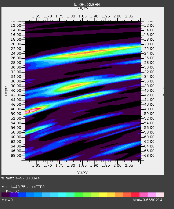
| Arrivals | |
| Ps | 4.8 SECOND |
| PpPs | 18 SECOND |
| PsPs/PpSs | 23 SECOND |

