You are here: Home > Network List > TA - USArray Transportable Network (new EarthScope stations) Stations List
> Station Z41A Richland Creek Farm, El Dorado, AR, USA > Earthquake Result Viewer
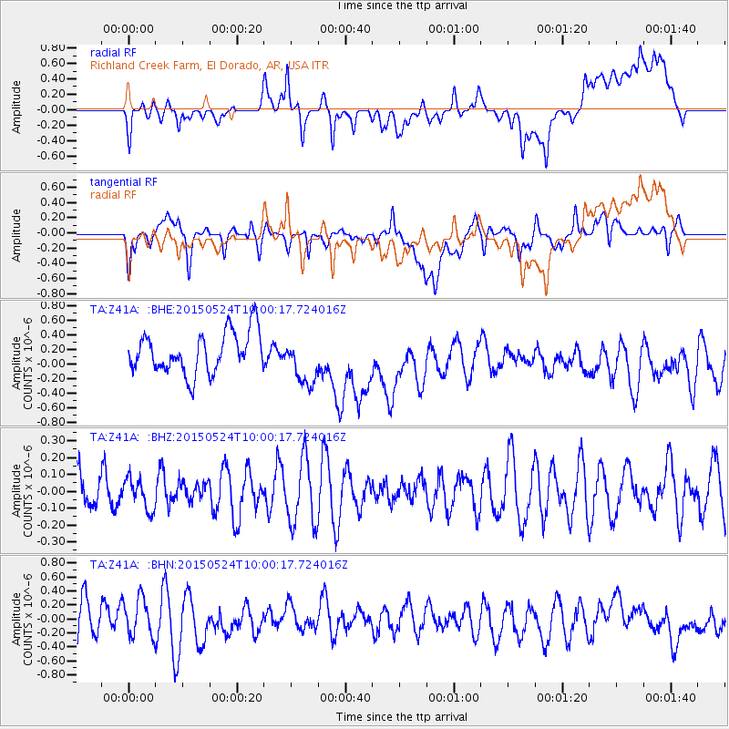
Z41A Richland Creek Farm, El Dorado, AR, USA - Earthquake Result Viewer
*The percent match for this event was below the threshold and hence no stack was calculated.
| Earthquake location: |
South Of Tonga Islands |
| Earthquake latitude/longitude: |
-24.1/-174.6 |
| Earthquake time(UTC): |
2015/05/24 (144) 09:47:20 GMT |
| Earthquake Depth: |
10 km |
| Earthquake Magnitude: |
4.8 mb, 4.7 mb, 3.4 MS |
| Earthquake Catalog/Contributor: |
ISC/ISC |
|
| Network: |
TA USArray Transportable Network (new EarthScope stations) |
| Station: |
Z41A Richland Creek Farm, El Dorado, AR, USA |
| Lat/Lon: |
33.26 N/92.80 W |
| Elevation: |
62 m |
|
| Distance: |
96.5 deg |
| Az: |
56.579 deg |
| Baz: |
245.575 deg |
| Ray Param: |
$rayparam |
*The percent match for this event was below the threshold and hence was not used in the summary stack. |
|
| Radial Match: |
47.69172 % |
| Radial Bump: |
400 |
| Transverse Match: |
48.27957 % |
| Transverse Bump: |
400 |
| SOD ConfigId: |
7422571 |
| Insert Time: |
2019-04-19 01:15:27.908 +0000 |
| GWidth: |
2.5 |
| Max Bumps: |
400 |
| Tol: |
0.001 |
|
Signal To Noise
| Channel | StoN | STA | LTA |
| TA:Z41A: :BHZ:20150524T10:00:17.724016Z | 0.6671758 | 9.350948E-8 | 1.4015718E-7 |
| TA:Z41A: :BHN:20150524T10:00:17.724016Z | 1.0122383 | 2.8057178E-7 | 2.771796E-7 |
| TA:Z41A: :BHE:20150524T10:00:17.724016Z | 1.1839856 | 3.3328493E-7 | 2.8149407E-7 |
| Arrivals |
| Ps | |
| PpPs | |
| PsPs/PpSs | |


