
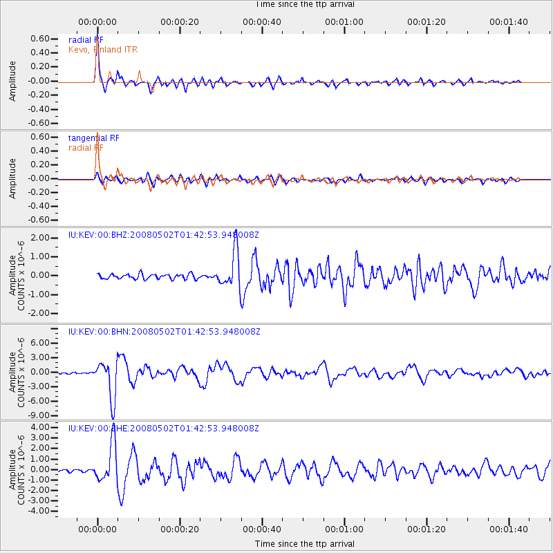
KEV Kevo, Finland - Earthquake Result Viewer
| ||||||||||||||||||
| ||||||||||||||||||
| ||||||||||||||||||
|
Signal To Noise
| Channel | StoN | STA | LTA |
| IU:KEV:00:BHN:20080502T01:42:53.948008Z | 18.40122 | 4.0977975E-6 | 2.2269163E-7 |
| IU:KEV:00:BHE:20080502T01:42:53.948008Z | 22.0865 | 1.9007363E-6 | 8.605874E-8 |
| IU:KEV:00:BHZ:20080502T01:42:53.948008Z | 7.9286795 | 1.0086081E-6 | 1.2721011E-7 |
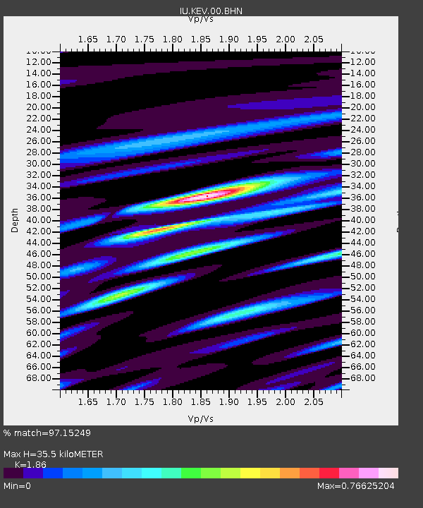
| Arrivals | |
| Ps | 4.8 SECOND |
| PpPs | 15 SECOND |
| PsPs/PpSs | 19 SECOND |

