You are here: Home > Network List > BK - Berkeley Digital Seismograph Network Stations List
> Station HUMO Hull Mountain, OR > Earthquake Result Viewer
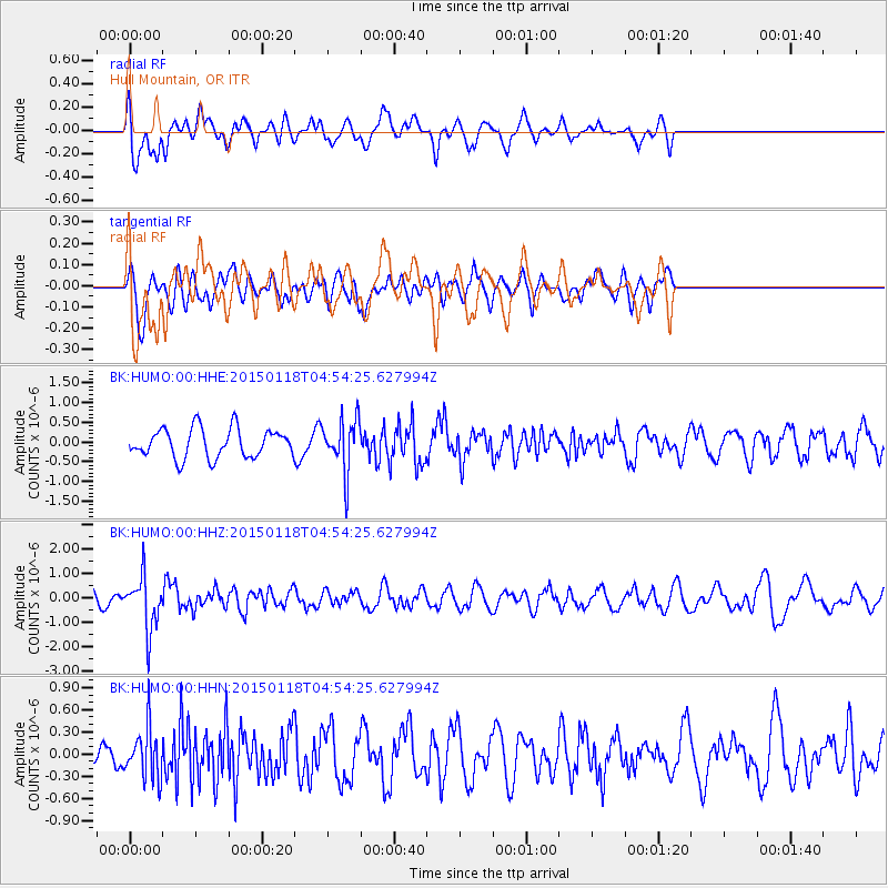
HUMO Hull Mountain, OR - Earthquake Result Viewer
*The percent match for this event was below the threshold and hence no stack was calculated.
| Earthquake location: |
Rat Islands, Aleutian Islands |
| Earthquake latitude/longitude: |
51.9/179.6 |
| Earthquake time(UTC): |
2015/01/18 (018) 04:47:38 GMT |
| Earthquake Depth: |
106 km |
| Earthquake Magnitude: |
5.8 MB, 5.9 MB |
| Earthquake Catalog/Contributor: |
NEIC PDE/NEIC COMCAT |
|
| Network: |
BK Berkeley Digital Seismograph Network |
| Station: |
HUMO Hull Mountain, OR |
| Lat/Lon: |
42.61 N/122.96 W |
| Elevation: |
555 m |
|
| Distance: |
39.2 deg |
| Az: |
80.31 deg |
| Baz: |
304.188 deg |
| Ray Param: |
$rayparam |
*The percent match for this event was below the threshold and hence was not used in the summary stack. |
|
| Radial Match: |
61.318684 % |
| Radial Bump: |
400 |
| Transverse Match: |
59.62459 % |
| Transverse Bump: |
400 |
| SOD ConfigId: |
837871 |
| Insert Time: |
2015-02-01 04:58:55.583 +0000 |
| GWidth: |
2.5 |
| Max Bumps: |
400 |
| Tol: |
0.001 |
|
Signal To Noise
| Channel | StoN | STA | LTA |
| BK:HUMO:00:HHZ:20150118T04:54:25.627994Z | 3.1296062 | 1.0960691E-6 | 3.502259E-7 |
| BK:HUMO:00:HHN:20150118T04:54:25.627994Z | 1.6269643 | 3.4792072E-7 | 2.1384655E-7 |
| BK:HUMO:00:HHE:20150118T04:54:25.627994Z | 1.8145456 | 6.6394705E-7 | 3.6590265E-7 |
| Arrivals |
| Ps | |
| PpPs | |
| PsPs/PpSs | |


