
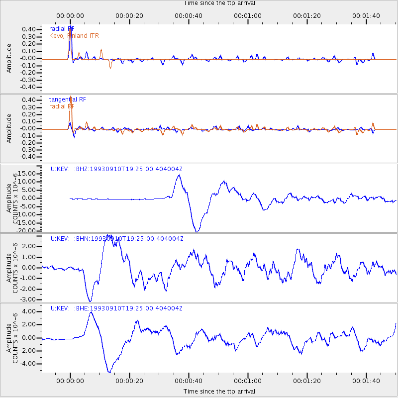
KEV Kevo, Finland - Earthquake Result Viewer
| ||||||||||||||||||
| ||||||||||||||||||
| ||||||||||||||||||
|
Signal To Noise
| Channel | StoN | STA | LTA |
| IU:KEV: :BHN:19930910T19:25:00.404004Z | 2.579822 | 2.3228839E-7 | 9.004047E-8 |
| IU:KEV: :BHE:19930910T19:25:00.404004Z | 3.4986699 | 3.262741E-7 | 9.325661E-8 |
| IU:KEV: :BHZ:19930910T19:25:00.404004Z | 8.842014 | 1.1903809E-6 | 1.3462778E-7 |
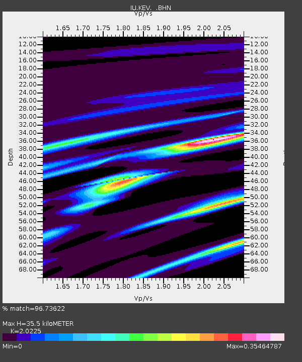
| Arrivals | |
| Ps | 5.6 SECOND |
| PpPs | 16 SECOND |
| PsPs/PpSs | 21 SECOND |

