
KEV Kevo, Finland - Earthquake Result Viewer
| ||||||||||||||||||
| ||||||||||||||||||
| ||||||||||||||||||
|
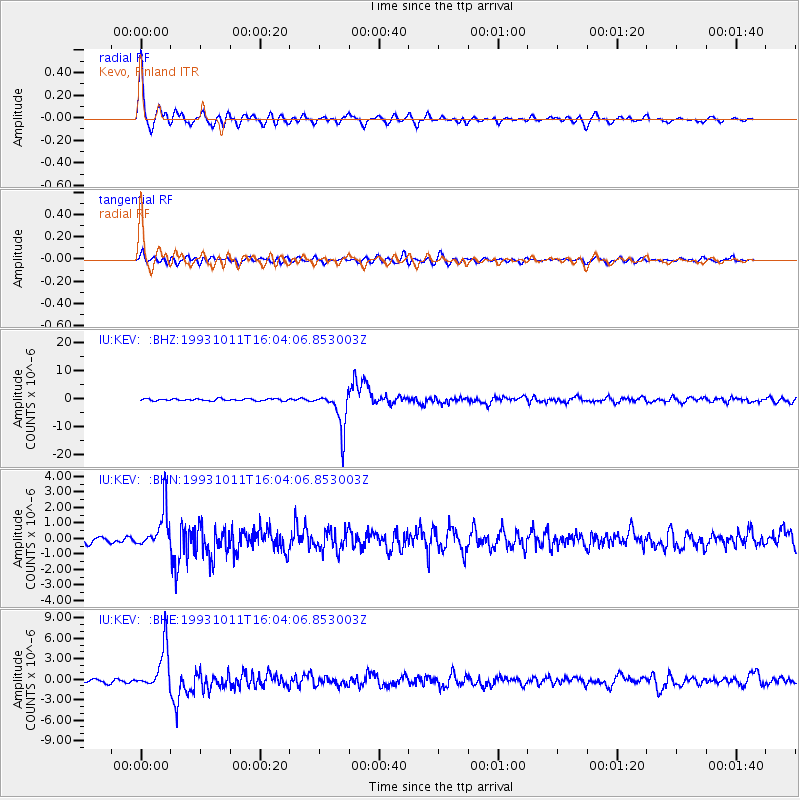
Signal To Noise
| Channel | StoN | STA | LTA |
| IU:KEV: :BHN:19931011T16:04:06.853003Z | 7.6826015 | 1.2711437E-6 | 1.6545745E-7 |
| IU:KEV: :BHE:19931011T16:04:06.853003Z | 13.543802 | 3.1378754E-6 | 2.316835E-7 |
| IU:KEV: :BHZ:19931011T16:04:06.853003Z | 20.133757 | 6.9652706E-6 | 3.459499E-7 |
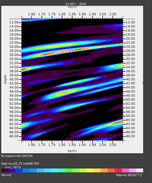
| Arrivals | |
| Ps | 3.3 SECOND |
| PpPs | 11 SECOND |
| PsPs/PpSs | 14 SECOND |

