You are here: Home > Network List > TA - USArray Transportable Network (new EarthScope stations) Stations List
> Station Z41A Richland Creek Farm, El Dorado, AR, USA > Earthquake Result Viewer
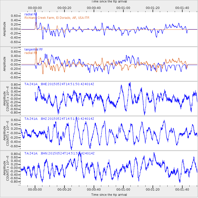
Z41A Richland Creek Farm, El Dorado, AR, USA - Earthquake Result Viewer
*The percent match for this event was below the threshold and hence no stack was calculated.
| Earthquake location: |
Tonga Islands |
| Earthquake latitude/longitude: |
-19.3/-175.9 |
| Earthquake time(UTC): |
2015/05/24 (144) 14:39:02 GMT |
| Earthquake Depth: |
35 km |
| Earthquake Magnitude: |
5.7 MB |
| Earthquake Catalog/Contributor: |
NEIC PDE/NEIC COMCAT |
|
| Network: |
TA USArray Transportable Network (new EarthScope stations) |
| Station: |
Z41A Richland Creek Farm, El Dorado, AR, USA |
| Lat/Lon: |
33.26 N/92.80 W |
| Elevation: |
62 m |
|
| Distance: |
94.9 deg |
| Az: |
56.608 deg |
| Baz: |
250.218 deg |
| Ray Param: |
$rayparam |
*The percent match for this event was below the threshold and hence was not used in the summary stack. |
|
| Radial Match: |
63.13915 % |
| Radial Bump: |
400 |
| Transverse Match: |
47.093056 % |
| Transverse Bump: |
400 |
| SOD ConfigId: |
7422571 |
| Insert Time: |
2019-04-19 01:21:56.573 +0000 |
| GWidth: |
2.5 |
| Max Bumps: |
400 |
| Tol: |
0.001 |
|
Signal To Noise
| Channel | StoN | STA | LTA |
| TA:Z41A: :BHZ:20150524T14:51:50.424014Z | 0.5715708 | 7.875284E-8 | 1.3778318E-7 |
| TA:Z41A: :BHN:20150524T14:51:50.424014Z | 1.3660147 | 5.173661E-7 | 3.7874125E-7 |
| TA:Z41A: :BHE:20150524T14:51:50.424014Z | 0.6591482 | 1.9877521E-7 | 3.0156374E-7 |
| Arrivals |
| Ps | |
| PpPs | |
| PsPs/PpSs | |


