
KEV Kevo, Finland - Earthquake Result Viewer
| ||||||||||||||||||
| ||||||||||||||||||
| ||||||||||||||||||
|
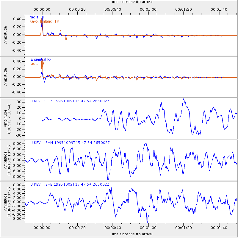
Signal To Noise
| Channel | StoN | STA | LTA |
| IU:KEV: :BHN:19951009T15:47:54.265002Z | 3.22749 | 2.3865387E-6 | 7.394411E-7 |
| IU:KEV: :BHE:19951009T15:47:54.265002Z | 2.3432279 | 1.5716732E-6 | 6.7073E-7 |
| IU:KEV: :BHZ:19951009T15:47:54.265002Z | 5.3720737 | 6.9858133E-6 | 1.3003943E-6 |
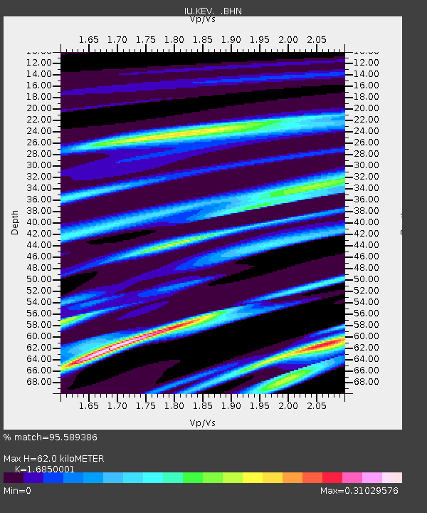
| Arrivals | |
| Ps | 6.6 SECOND |
| PpPs | 24 SECOND |
| PsPs/PpSs | 31 SECOND |

