KEV Kevo, Finland - Earthquake Result Viewer
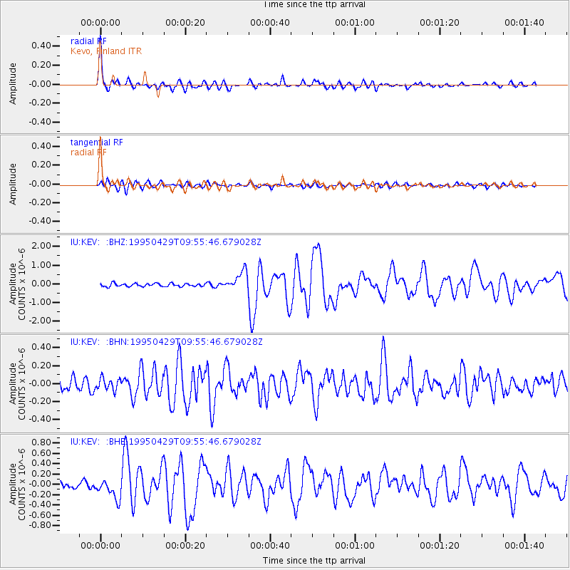
Earthquake location: Philippine Islands Region
Earthquake latitude/longitude: 11.8/126.0
Earthquake time(UTC): 1995/04/29 (119) 09:44:00 GMT
Earthquake Depth: 33 km
Earthquake Magnitude: 5.4 MB, 6.0 MS, 6.1 UNKNOWN, 6.0 MW
Earthquake Catalog/Contributor: WHDF/NEIC
Network: IU Global Seismograph Network (GSN - IRIS/USGS)
Station: KEV Kevo, Finland
Lat/Lon: 69.76 N/27.01 E
Elevation: 80 m
Distance: 82.2 deg
Az: 339.696 deg
Baz: 77.482 deg
Ray Param: 0.047035437
Estimated Moho Depth: 42.25 km
Estimated Crust Vp/Vs: 2.04
Assumed Crust Vp: 6.622 km/s
Estimated Crust Vs: 3.246 km/s
Estimated Crust Poisson's Ratio: 0.34
Radial Match: 94.78884 %
Radial Bump: 391
Transverse Match: 82.51215 %
Transverse Bump: 400
SOD ConfigId: 6273
Insert Time: 2010-03-02 15:33:17.574 +0000
GWidth: 2.5
Max Bumps: 400
Tol: 0.001

Signal To Noise

ChannelStoNSTALTA
IU:KEV: :BHN:19950429T09:55:46.679028Z1.21126036.650304E-85.4904E-8
IU:KEV: :BHE:19950429T09:55:46.679028Z3.17151931.9660055E-76.198939E-8
IU:KEV: :BHZ:19950429T09:55:46.679028Z6.25217345.148811E-78.235233E-8
Arrivals
Ps6.8 SECOND
PpPs19 SECOND
PsPs/PpSs26 SECOND