
KEV Kevo, Finland - Earthquake Result Viewer
| ||||||||||||||||||
| ||||||||||||||||||
| ||||||||||||||||||
|
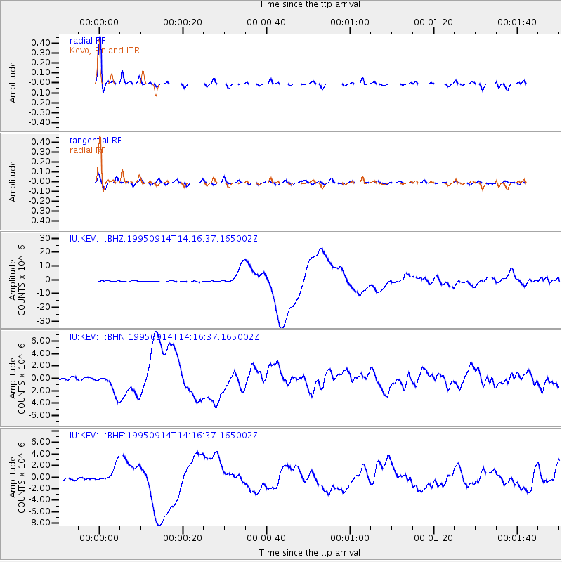
Signal To Noise
| Channel | StoN | STA | LTA |
| IU:KEV: :BHN:19950914T14:16:37.165002Z | 10.317225 | 1.7707055E-6 | 1.7162613E-7 |
| IU:KEV: :BHE:19950914T14:16:37.165002Z | 7.56293 | 1.6508194E-6 | 2.1827776E-7 |
| IU:KEV: :BHZ:19950914T14:16:37.165002Z | 22.289848 | 7.0059973E-6 | 3.1431338E-7 |
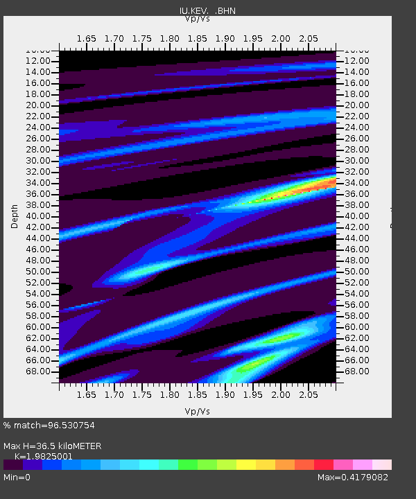
| Arrivals | |
| Ps | 5.5 SECOND |
| PpPs | 16 SECOND |
| PsPs/PpSs | 22 SECOND |

