
KEV Kevo, Finland - Earthquake Result Viewer
| ||||||||||||||||||
| ||||||||||||||||||
| ||||||||||||||||||
|
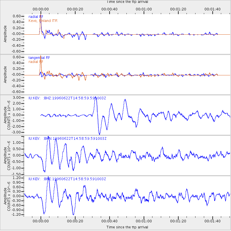
Signal To Noise
| Channel | StoN | STA | LTA |
| IU:KEV: :BHN:19960622T14:58:59.591003Z | 8.275706 | 9.0033063E-7 | 1.08792E-7 |
| IU:KEV: :BHE:19960622T14:58:59.591003Z | 5.862411 | 7.597595E-7 | 1.2959846E-7 |
| IU:KEV: :BHZ:19960622T14:58:59.591003Z | 18.113459 | 2.0795192E-6 | 1.1480519E-7 |
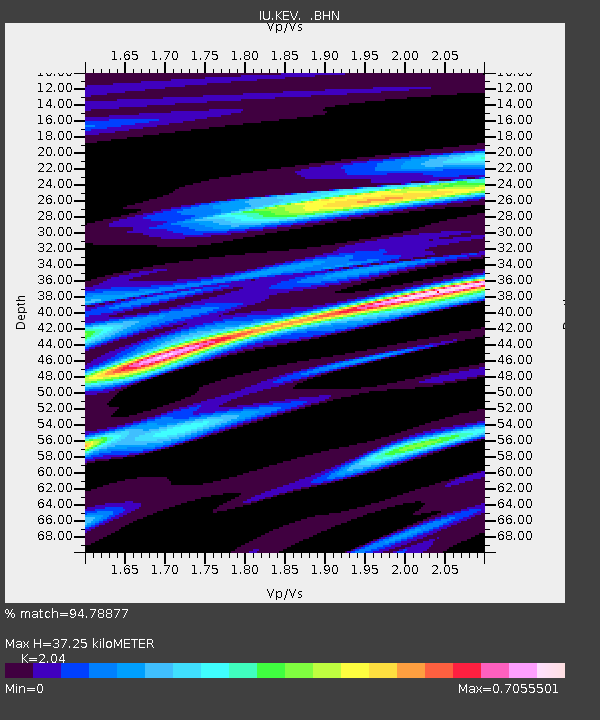
| Arrivals | |
| Ps | 6.1 SECOND |
| PpPs | 16 SECOND |
| PsPs/PpSs | 22 SECOND |

