KEV Kevo, Finland - Earthquake Result Viewer
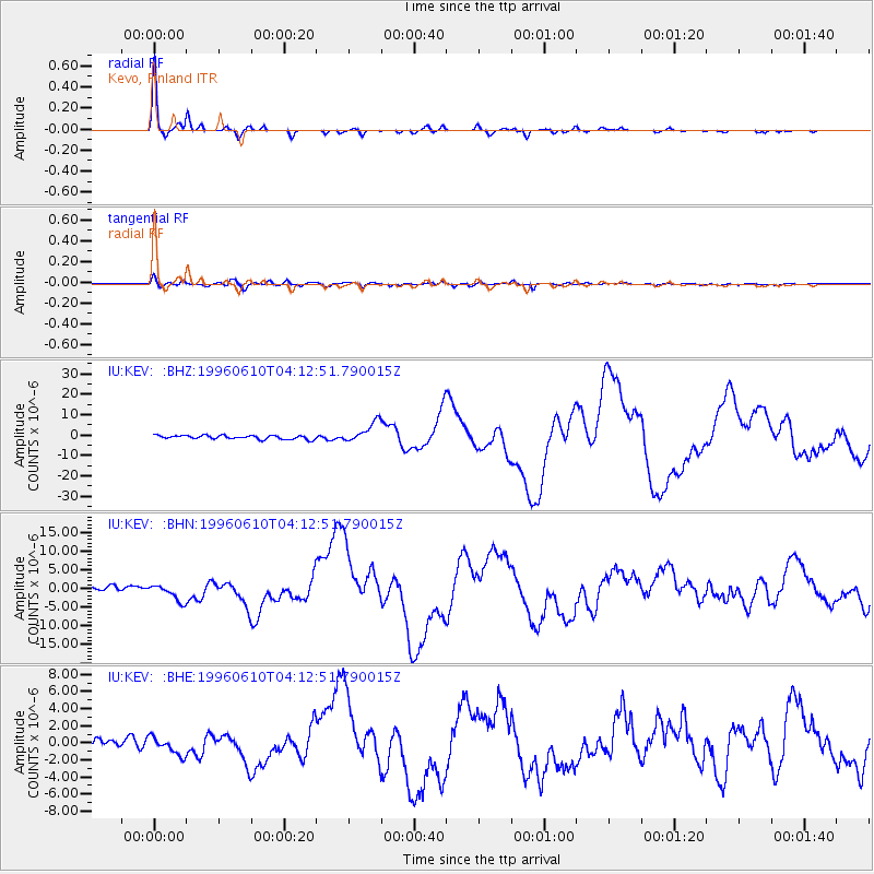
Earthquake location: Andreanof Islands, Aleutian Is.
Earthquake latitude/longitude: 51.6/-177.6
Earthquake time(UTC): 1996/06/10 (162) 04:03:35 GMT
Earthquake Depth: 33 km
Earthquake Magnitude: 6.6 MB, 7.6 MS, 7.9 UNKNOWN, 7.4 MS
Earthquake Catalog/Contributor: WHDF/NEIC
Network: IU Global Seismograph Network (GSN - IRIS/USGS)
Station: KEV Kevo, Finland
Lat/Lon: 69.76 N/27.01 E
Elevation: 80 m
Distance: 57.7 deg
Az: 350.11 deg
Baz: 17.938 deg
Ray Param: 0.063291565
Estimated Moho Depth: 40.75 km
Estimated Crust Vp/Vs: 1.80
Assumed Crust Vp: 6.622 km/s
Estimated Crust Vs: 3.674 km/s
Estimated Crust Poisson's Ratio: 0.28
Radial Match: 98.079124 %
Radial Bump: 232
Transverse Match: 82.83033 %
Transverse Bump: 400
SOD ConfigId: 6273
Insert Time: 2010-03-02 15:33:46.599 +0000
GWidth: 2.5
Max Bumps: 400
Tol: 0.001

Signal To Noise

ChannelStoNSTALTA
IU:KEV: :BHN:19960610T04:12:51.790015Z4.7318692.2810327E-64.8205743E-7
IU:KEV: :BHE:19960610T04:12:51.790015Z2.64688851.0842787E-64.0964275E-7
IU:KEV: :BHZ:19960610T04:12:51.790015Z5.44673734.9559712E-69.0989727E-7
Arrivals
Ps5.2 SECOND
PpPs16 SECOND
PsPs/PpSs22 SECOND