KEV Kevo, Finland - Earthquake Result Viewer
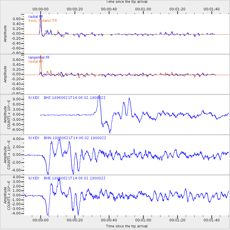
Earthquake location: Off East Coast Of Kamchatka
Earthquake latitude/longitude: 51.6/159.1
Earthquake time(UTC): 1996/06/21 (173) 13:57:10 GMT
Earthquake Depth: 20 km
Earthquake Magnitude: 6.0 MB, 6.6 MS, 7.0 UNKNOWN, 6.5 MS
Earthquake Catalog/Contributor: WHDF/NEIC
Network: IU Global Seismograph Network (GSN - IRIS/USGS)
Station: KEV Kevo, Finland
Lat/Lon: 69.76 N/27.01 E
Elevation: 80 m
Distance: 54.1 deg
Az: 341.405 deg
Baz: 34.875 deg
Ray Param: 0.065652914
Estimated Moho Depth: 39.0 km
Estimated Crust Vp/Vs: 1.99
Assumed Crust Vp: 6.622 km/s
Estimated Crust Vs: 3.336 km/s
Estimated Crust Poisson's Ratio: 0.33
Radial Match: 98.007065 %
Radial Bump: 242
Transverse Match: 89.51327 %
Transverse Bump: 400
SOD ConfigId: 6273
Insert Time: 2010-03-02 15:34:03.328 +0000
GWidth: 2.5
Max Bumps: 400
Tol: 0.001

Signal To Noise

ChannelStoNSTALTA
IU:KEV: :BHN:19960621T14:06:02.190002Z29.7847542.3317066E-67.828524E-8
IU:KEV: :BHE:19960621T14:06:02.190002Z25.3878272.0656744E-68.136475E-8
IU:KEV: :BHZ:19960621T14:06:02.190002Z41.540175.5150413E-61.3276406E-7
Arrivals
Ps6.1 SECOND
PpPs17 SECOND
PsPs/PpSs23 SECOND