You are here: Home > Network List > TA - USArray Transportable Network (new EarthScope stations) Stations List
> Station R11A Troy Canyon, Currant, NV, USA > Earthquake Result Viewer
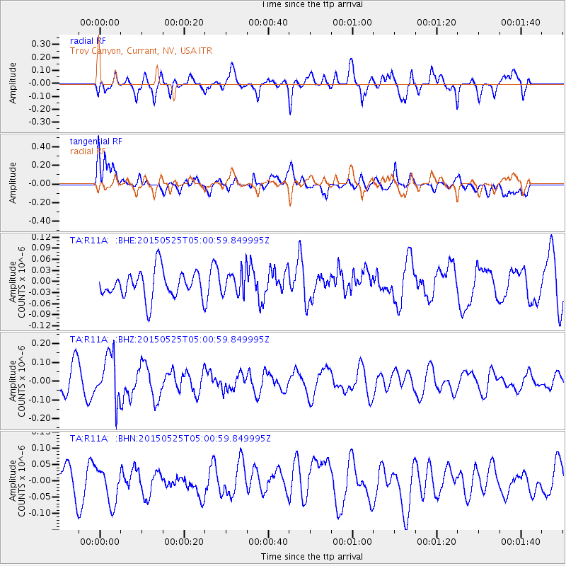
R11A Troy Canyon, Currant, NV, USA - Earthquake Result Viewer
*The percent match for this event was below the threshold and hence no stack was calculated.
| Earthquake location: |
Solomon Islands |
| Earthquake latitude/longitude: |
-6.4/155.0 |
| Earthquake time(UTC): |
2015/05/25 (145) 04:48:23 GMT |
| Earthquake Depth: |
71 km |
| Earthquake Magnitude: |
5.5 MB |
| Earthquake Catalog/Contributor: |
NEIC PDE/NEIC COMCAT |
|
| Network: |
TA USArray Transportable Network (new EarthScope stations) |
| Station: |
R11A Troy Canyon, Currant, NV, USA |
| Lat/Lon: |
38.35 N/115.59 W |
| Elevation: |
1756 m |
|
| Distance: |
93.5 deg |
| Az: |
51.972 deg |
| Baz: |
264.626 deg |
| Ray Param: |
$rayparam |
*The percent match for this event was below the threshold and hence was not used in the summary stack. |
|
| Radial Match: |
61.246967 % |
| Radial Bump: |
400 |
| Transverse Match: |
50.859188 % |
| Transverse Bump: |
400 |
| SOD ConfigId: |
7422571 |
| Insert Time: |
2019-04-19 01:30:57.615 +0000 |
| GWidth: |
2.5 |
| Max Bumps: |
400 |
| Tol: |
0.001 |
|
Signal To Noise
| Channel | StoN | STA | LTA |
| TA:R11A: :BHZ:20150525T05:00:59.849995Z | 1.8786805 | 1.2534356E-7 | 6.671894E-8 |
| TA:R11A: :BHN:20150525T05:00:59.849995Z | 1.0218964 | 5.359845E-8 | 5.2449984E-8 |
| TA:R11A: :BHE:20150525T05:00:59.849995Z | 0.92291015 | 3.4751405E-8 | 3.765416E-8 |
| Arrivals |
| Ps | |
| PpPs | |
| PsPs/PpSs | |


