
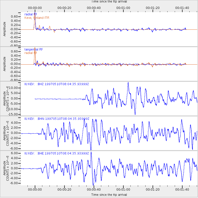
KEV Kevo, Finland - Earthquake Result Viewer
| ||||||||||||||||||
| ||||||||||||||||||
| ||||||||||||||||||
|
Signal To Noise
| Channel | StoN | STA | LTA |
| IU:KEV: :BHN:19970510T08:04:35.93999Z | 4.969743 | 3.6867945E-7 | 7.418482E-8 |
| IU:KEV: :BHE:19970510T08:04:35.93999Z | 5.456319 | 3.3153455E-7 | 6.076158E-8 |
| IU:KEV: :BHZ:19970510T08:04:35.93999Z | 8.473242 | 8.6025756E-7 | 1.01526375E-7 |
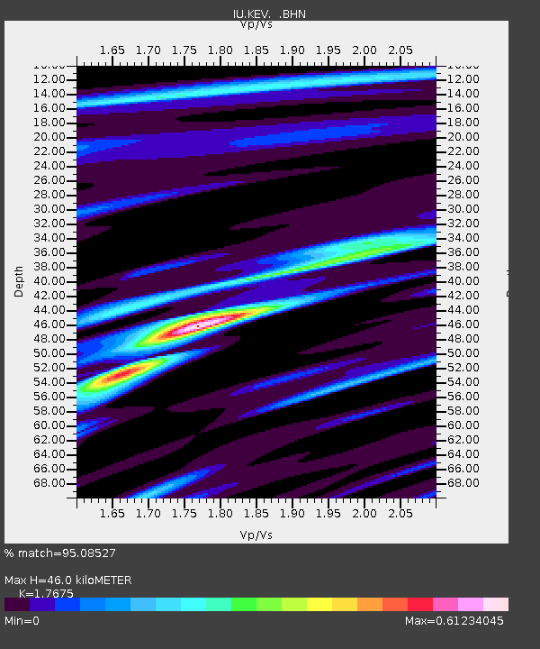
| Arrivals | |
| Ps | 5.7 SECOND |
| PpPs | 18 SECOND |
| PsPs/PpSs | 24 SECOND |

