
KEV Kevo, Finland - Earthquake Result Viewer
| ||||||||||||||||||
| ||||||||||||||||||
| ||||||||||||||||||
|
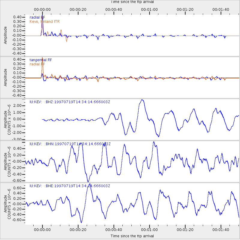
Signal To Noise
| Channel | StoN | STA | LTA |
| IU:KEV: :BHN:19970719T14:34:14.666003Z | 1.6592493 | 7.7112944E-8 | 4.6474597E-8 |
| IU:KEV: :BHE:19970719T14:34:14.666003Z | 1.7929469 | 8.239494E-8 | 4.5955034E-8 |
| IU:KEV: :BHZ:19970719T14:34:14.666003Z | 3.0530846 | 2.4083516E-7 | 7.888258E-8 |
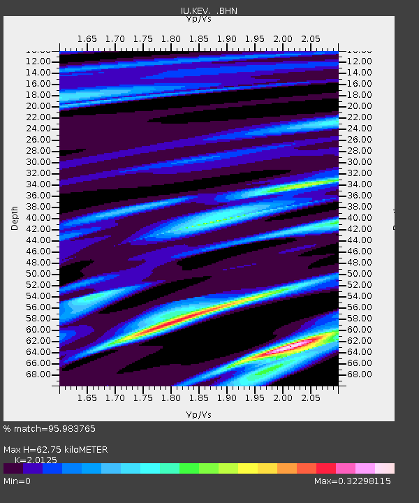
| Arrivals | |
| Ps | 9.8 SECOND |
| PpPs | 28 SECOND |
| PsPs/PpSs | 38 SECOND |

