You are here: Home > Network List > TA - USArray Transportable Network (new EarthScope stations) Stations List
> Station O48A Farmland, IN, USA > Earthquake Result Viewer
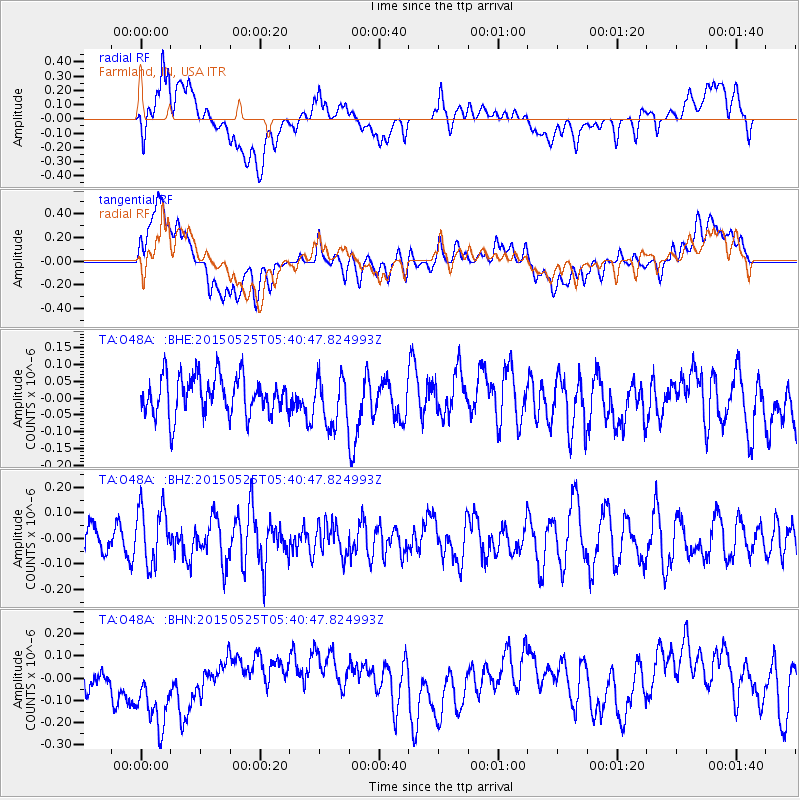
O48A Farmland, IN, USA - Earthquake Result Viewer
*The percent match for this event was below the threshold and hence no stack was calculated.
| Earthquake location: |
Eastern Honshu, Japan |
| Earthquake latitude/longitude: |
36.0/139.6 |
| Earthquake time(UTC): |
2015/05/25 (145) 05:28:09 GMT |
| Earthquake Depth: |
62 km |
| Earthquake Magnitude: |
5.2 MW, 5.3 mb |
| Earthquake Catalog/Contributor: |
ISC/ISC |
|
| Network: |
TA USArray Transportable Network (new EarthScope stations) |
| Station: |
O48A Farmland, IN, USA |
| Lat/Lon: |
40.26 N/85.16 W |
| Elevation: |
300 m |
|
| Distance: |
93.6 deg |
| Az: |
32.689 deg |
| Baz: |
325.104 deg |
| Ray Param: |
$rayparam |
*The percent match for this event was below the threshold and hence was not used in the summary stack. |
|
| Radial Match: |
54.028297 % |
| Radial Bump: |
400 |
| Transverse Match: |
51.752346 % |
| Transverse Bump: |
400 |
| SOD ConfigId: |
7422571 |
| Insert Time: |
2019-04-19 01:39:08.908 +0000 |
| GWidth: |
2.5 |
| Max Bumps: |
400 |
| Tol: |
0.001 |
|
Signal To Noise
| Channel | StoN | STA | LTA |
| TA:O48A: :BHZ:20150525T05:40:47.824993Z | 1.4061347 | 1.1279123E-7 | 8.021367E-8 |
| TA:O48A: :BHN:20150525T05:40:47.824993Z | 2.878142 | 1.873938E-7 | 6.510929E-8 |
| TA:O48A: :BHE:20150525T05:40:47.824993Z | 1.2362334 | 7.1254476E-8 | 5.763837E-8 |
| Arrivals |
| Ps | |
| PpPs | |
| PsPs/PpSs | |


