
KEV Kevo, Finland - Earthquake Result Viewer
| ||||||||||||||||||
| ||||||||||||||||||
| ||||||||||||||||||
|
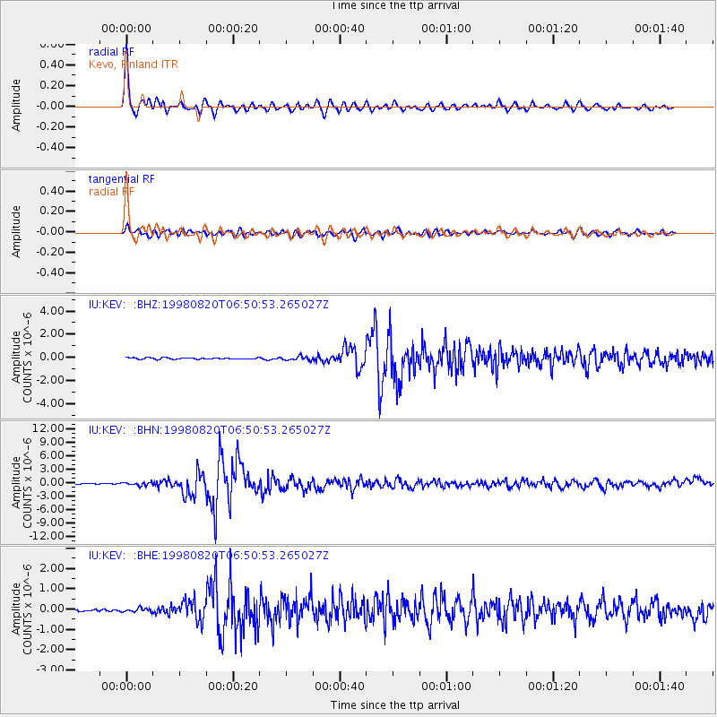
Signal To Noise
| Channel | StoN | STA | LTA |
| IU:KEV: :BHN:19980820T06:50:53.265027Z | 3.9256449 | 3.4390504E-7 | 8.7604725E-8 |
| IU:KEV: :BHE:19980820T06:50:53.265027Z | 1.4522287 | 9.0314295E-8 | 6.219013E-8 |
| IU:KEV: :BHZ:19980820T06:50:53.265027Z | 2.6671834 | 1.7420268E-7 | 6.5313344E-8 |
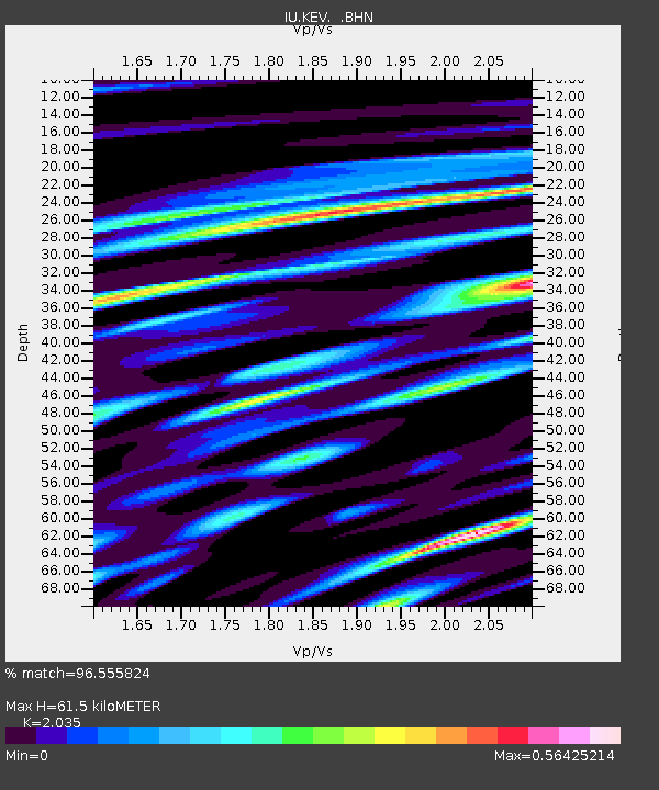
| Arrivals | |
| Ps | 9.9 SECOND |
| PpPs | 27 SECOND |
| PsPs/PpSs | 37 SECOND |

