
KEV Kevo, Finland - Earthquake Result Viewer
| ||||||||||||||||||
| ||||||||||||||||||
| ||||||||||||||||||
|
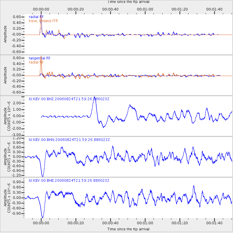
Signal To Noise
| Channel | StoN | STA | LTA |
| IU:KEV:00:BHN:20060824T21:59:26.886023Z | 15.496845 | 6.8001924E-7 | 4.388114E-8 |
| IU:KEV:00:BHE:20060824T21:59:26.886023Z | 14.757202 | 6.136451E-7 | 4.158275E-8 |
| IU:KEV:00:BHZ:20060824T21:59:26.886023Z | 22.073725 | 1.6934545E-6 | 7.671811E-8 |
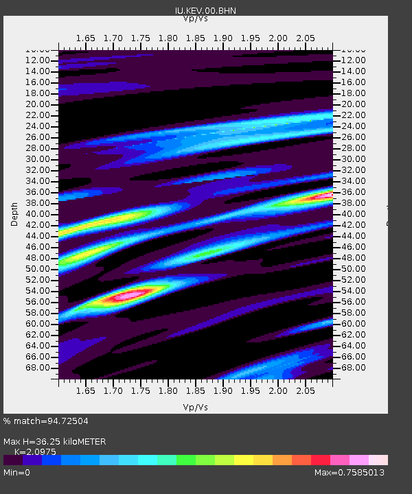
| Arrivals | |
| Ps | 6.3 SECOND |
| PpPs | 16 SECOND |
| PsPs/PpSs | 22 SECOND |

