
KEV Kevo, Finland - Earthquake Result Viewer
| ||||||||||||||||||
| ||||||||||||||||||
| ||||||||||||||||||
|
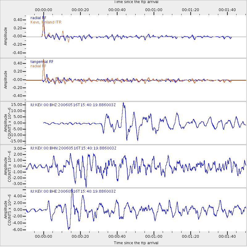
Signal To Noise
| Channel | StoN | STA | LTA |
| IU:KEV:00:BHN:20060516T15:40:19.886003Z | 0.9967212 | 3.273529E-7 | 3.2842976E-7 |
| IU:KEV:00:BHE:20060516T15:40:19.886003Z | 3.8625786 | 1.52717E-6 | 3.9537574E-7 |
| IU:KEV:00:BHZ:20060516T15:40:19.886003Z | 8.764531 | 3.9681345E-6 | 4.5274922E-7 |
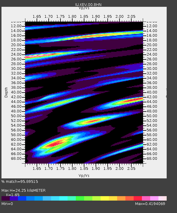
| Arrivals | |
| Ps | 2.5 SECOND |
| PpPs | 9.4 SECOND |
| PsPs/PpSs | 12 SECOND |

