
KEV Kevo, Finland - Earthquake Result Viewer
| ||||||||||||||||||
| ||||||||||||||||||
| ||||||||||||||||||
|
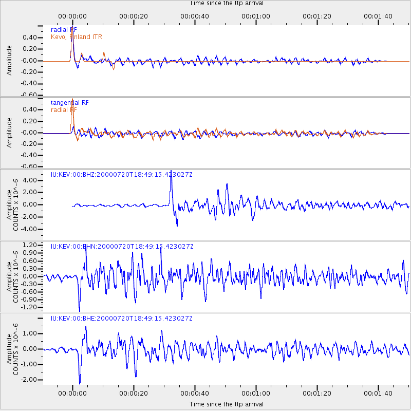
Signal To Noise
| Channel | StoN | STA | LTA |
| IU:KEV:00:BHN:20000720T18:49:15.423027Z | 8.351862 | 5.0225776E-7 | 6.013722E-8 |
| IU:KEV:00:BHE:20000720T18:49:15.423027Z | 13.246419 | 8.5309017E-7 | 6.440157E-8 |
| IU:KEV:00:BHZ:20000720T18:49:15.423027Z | 14.118406 | 1.9149566E-6 | 1.3563546E-7 |
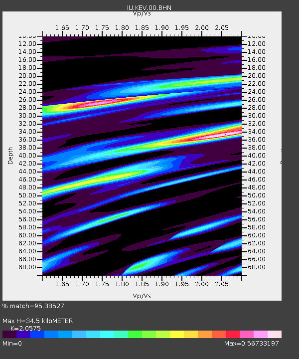
| Arrivals | |
| Ps | 5.7 SECOND |
| PpPs | 15 SECOND |
| PsPs/PpSs | 21 SECOND |

