
KEV Kevo, Finland - Earthquake Result Viewer
| ||||||||||||||||||
| ||||||||||||||||||
| ||||||||||||||||||
|
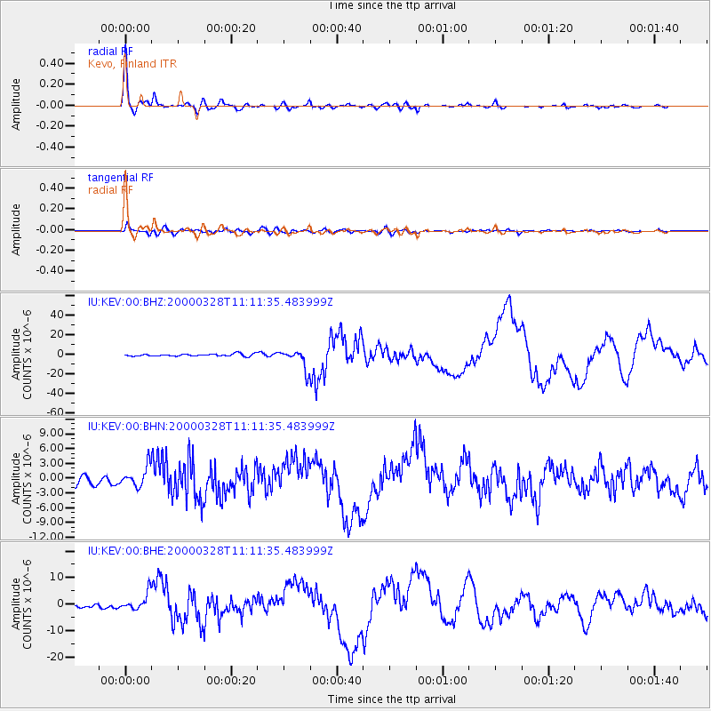
Signal To Noise
| Channel | StoN | STA | LTA |
| IU:KEV:00:BHN:20000328T11:11:35.483999Z | 2.8978286 | 2.1055566E-6 | 7.265981E-7 |
| IU:KEV:00:BHE:20000328T11:11:35.483999Z | 6.5307293 | 3.3185945E-6 | 5.0815066E-7 |
| IU:KEV:00:BHZ:20000328T11:11:35.483999Z | 8.571542 | 1.0066393E-5 | 1.174397E-6 |
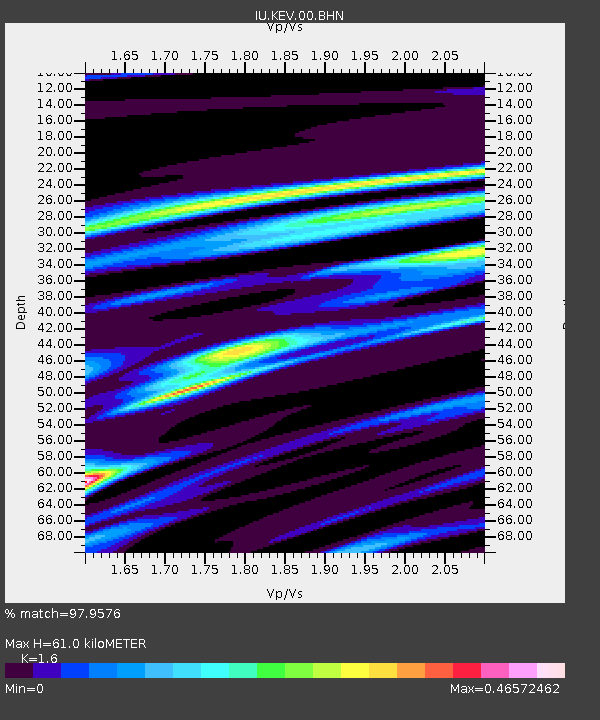
| Arrivals | |
| Ps | 5.7 SECOND |
| PpPs | 23 SECOND |
| PsPs/PpSs | 29 SECOND |

