
OSI Osito Adit, California, USA - Earthquake Result Viewer
| ||||||||||||||||||
| ||||||||||||||||||
| ||||||||||||||||||
|
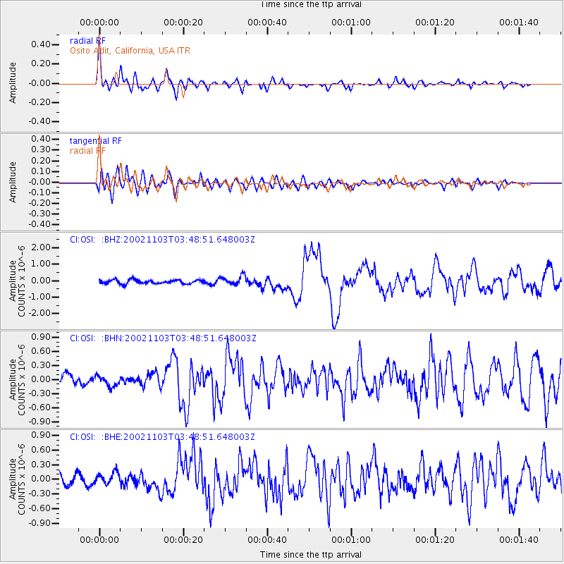
Signal To Noise
| Channel | StoN | STA | LTA |
| CI:OSI: :BHN:20021103T03:48:51.648003Z | 0.76936406 | 1.0409552E-7 | 1.3530074E-7 |
| CI:OSI: :BHE:20021103T03:48:51.648003Z | 0.88563806 | 1.1648673E-7 | 1.315286E-7 |
| CI:OSI: :BHZ:20021103T03:48:51.648003Z | 2.327104 | 2.7885272E-7 | 1.198282E-7 |
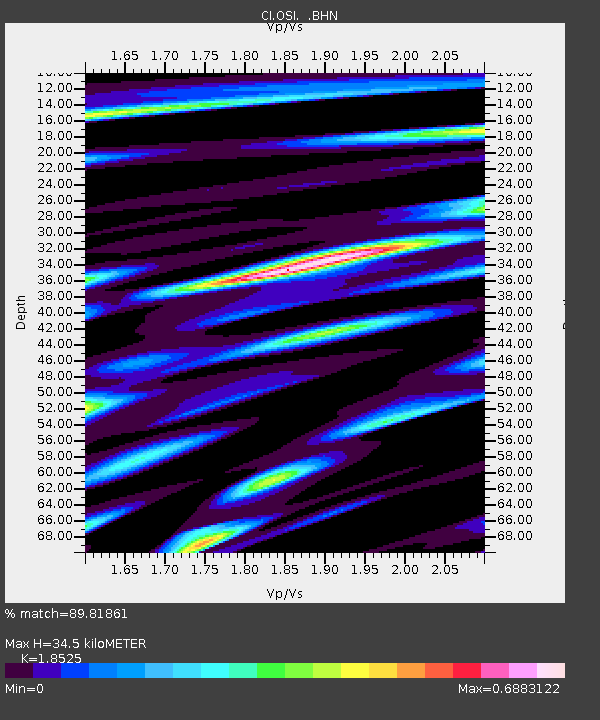
| Arrivals | |
| Ps | 5.0 SECOND |
| PpPs | 16 SECOND |
| PsPs/PpSs | 21 SECOND |

