You are here: Home > Network List > CI - Caltech Regional Seismic Network Stations List
> Station MPP McPhearson Peak > Earthquake Result Viewer
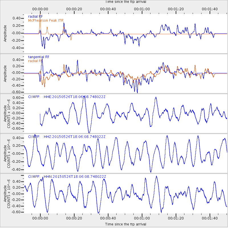
MPP McPhearson Peak - Earthquake Result Viewer
*The percent match for this event was below the threshold and hence no stack was calculated.
| Earthquake location: |
East Of Kuril Islands |
| Earthquake latitude/longitude: |
45.9/152.4 |
| Earthquake time(UTC): |
2015/05/26 (146) 17:56:06 GMT |
| Earthquake Depth: |
41 km |
| Earthquake Magnitude: |
4.3 mb, 4.0 mb |
| Earthquake Catalog/Contributor: |
ISC/ISC |
|
| Network: |
CI Caltech Regional Seismic Network |
| Station: |
MPP McPhearson Peak |
| Lat/Lon: |
34.89 N/119.81 W |
| Elevation: |
1739 m |
|
| Distance: |
64.6 deg |
| Az: |
65.466 deg |
| Baz: |
309.365 deg |
| Ray Param: |
$rayparam |
*The percent match for this event was below the threshold and hence was not used in the summary stack. |
|
| Radial Match: |
50.385548 % |
| Radial Bump: |
400 |
| Transverse Match: |
54.32073 % |
| Transverse Bump: |
400 |
| SOD ConfigId: |
7422571 |
| Insert Time: |
2019-04-19 02:11:03.744 +0000 |
| GWidth: |
2.5 |
| Max Bumps: |
400 |
| Tol: |
0.001 |
|
Signal To Noise
| Channel | StoN | STA | LTA |
| CI:MPP: :HHZ:20150526T18:06:08.748022Z | 0.8886732 | 1.7611636E-7 | 1.98179E-7 |
| CI:MPP: :HHN:20150526T18:06:08.748022Z | 1.4004931 | 4.9022435E-7 | 3.5003697E-7 |
| CI:MPP: :HHE:20150526T18:06:08.748022Z | 1.5791146 | 3.492721E-7 | 2.2118225E-7 |
| Arrivals |
| Ps | |
| PpPs | |
| PsPs/PpSs | |


