You are here: Home > Network List > TA - USArray Transportable Network (new EarthScope stations) Stations List
> Station Z41A Richland Creek Farm, El Dorado, AR, USA > Earthquake Result Viewer
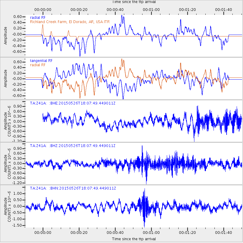
Z41A Richland Creek Farm, El Dorado, AR, USA - Earthquake Result Viewer
*The percent match for this event was below the threshold and hence no stack was calculated.
| Earthquake location: |
East Of Kuril Islands |
| Earthquake latitude/longitude: |
45.9/152.4 |
| Earthquake time(UTC): |
2015/05/26 (146) 17:56:06 GMT |
| Earthquake Depth: |
41 km |
| Earthquake Magnitude: |
4.3 mb, 4.0 mb |
| Earthquake Catalog/Contributor: |
ISC/ISC |
|
| Network: |
TA USArray Transportable Network (new EarthScope stations) |
| Station: |
Z41A Richland Creek Farm, El Dorado, AR, USA |
| Lat/Lon: |
33.26 N/92.80 W |
| Elevation: |
62 m |
|
| Distance: |
81.7 deg |
| Az: |
50.252 deg |
| Baz: |
320.128 deg |
| Ray Param: |
$rayparam |
*The percent match for this event was below the threshold and hence was not used in the summary stack. |
|
| Radial Match: |
57.79912 % |
| Radial Bump: |
400 |
| Transverse Match: |
51.105373 % |
| Transverse Bump: |
400 |
| SOD ConfigId: |
7422571 |
| Insert Time: |
2019-04-19 02:15:34.924 +0000 |
| GWidth: |
2.5 |
| Max Bumps: |
400 |
| Tol: |
0.001 |
|
Signal To Noise
| Channel | StoN | STA | LTA |
| TA:Z41A: :BHZ:20150526T18:07:49.449011Z | 1.1124617 | 1.3745843E-7 | 1.235624E-7 |
| TA:Z41A: :BHN:20150526T18:07:49.449011Z | 1.3062043 | 2.7124244E-7 | 2.0765697E-7 |
| TA:Z41A: :BHE:20150526T18:07:49.449011Z | 1.5164021 | 3.1527304E-7 | 2.0790858E-7 |
| Arrivals |
| Ps | |
| PpPs | |
| PsPs/PpSs | |


