You are here: Home > Network List > US - United States National Seismic Network Stations List
> Station EGMT Eagleton, Montana, USA > Earthquake Result Viewer
EGMT Eagleton, Montana, USA - Earthquake Result Viewer
*The percent match for this event was below the threshold and hence no stack was calculated.
| Earthquake location: |
East Of Kuril Islands |
| Earthquake latitude/longitude: |
45.9/152.4 |
| Earthquake time(UTC): |
2015/05/26 (146) 17:56:06 GMT |
| Earthquake Depth: |
41 km |
| Earthquake Magnitude: |
4.3 mb, 4.0 mb |
| Earthquake Catalog/Contributor: |
ISC/ISC |
|
| Network: |
US United States National Seismic Network |
| Station: |
EGMT Eagleton, Montana, USA |
| Lat/Lon: |
48.02 N/109.75 W |
| Elevation: |
1055 m |
|
| Distance: |
62.2 deg |
| Az: |
48.748 deg |
| Baz: |
308.517 deg |
| Ray Param: |
$rayparam |
*The percent match for this event was below the threshold and hence was not used in the summary stack. |
|
| Radial Match: |
35.305847 % |
| Radial Bump: |
400 |
| Transverse Match: |
48.01717 % |
| Transverse Bump: |
400 |
| SOD ConfigId: |
7422571 |
| Insert Time: |
2019-04-19 02:16:00.479 +0000 |
| GWidth: |
2.5 |
| Max Bumps: |
400 |
| Tol: |
0.001 |
|
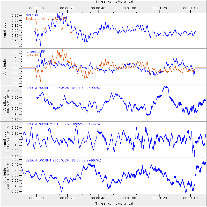
Signal To Noise
| Channel | StoN | STA | LTA |
| US:EGMT:00:BHZ:20150526T18:05:53.249976Z | 0.7067431 | 6.970531E-8 | 9.862892E-8 |
| US:EGMT:00:BH1:20150526T18:05:53.249976Z | 0.6108251 | 1.3259177E-7 | 2.1706991E-7 |
| US:EGMT:00:BH2:20150526T18:05:53.249976Z | 1.441678 | 2.2334109E-7 | 1.5491744E-7 |
| Arrivals |
| Ps | |
| PpPs | |
| PsPs/PpSs | |


