You are here: Home > Network List > UU - University of Utah Regional Network Stations List
> Station CCUT Cedar City, UT, USA > Earthquake Result Viewer
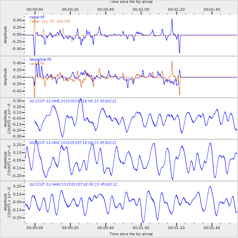
CCUT Cedar City, UT, USA - Earthquake Result Viewer
*The percent match for this event was below the threshold and hence no stack was calculated.
| Earthquake location: |
East Of Kuril Islands |
| Earthquake latitude/longitude: |
45.9/152.4 |
| Earthquake time(UTC): |
2015/05/26 (146) 17:56:06 GMT |
| Earthquake Depth: |
41 km |
| Earthquake Magnitude: |
4.3 mb, 4.0 mb |
| Earthquake Catalog/Contributor: |
ISC/ISC |
|
| Network: |
UU University of Utah Regional Network |
| Station: |
CCUT Cedar City, UT, USA |
| Lat/Lon: |
37.55 N/113.36 W |
| Elevation: |
2127 m |
|
| Distance: |
66.8 deg |
| Az: |
59.555 deg |
| Baz: |
310.728 deg |
| Ray Param: |
$rayparam |
*The percent match for this event was below the threshold and hence was not used in the summary stack. |
|
| Radial Match: |
57.462753 % |
| Radial Bump: |
392 |
| Transverse Match: |
71.24405 % |
| Transverse Bump: |
400 |
| SOD ConfigId: |
7422571 |
| Insert Time: |
2019-04-19 02:16:13.343 +0000 |
| GWidth: |
2.5 |
| Max Bumps: |
400 |
| Tol: |
0.001 |
|
Signal To Noise
| Channel | StoN | STA | LTA |
| UU:CCUT:01:HHZ:20150526T18:06:23.459021Z | 1.0297352 | 1.6226363E-7 | 1.5757801E-7 |
| UU:CCUT:01:HHN:20150526T18:06:23.459021Z | 0.48039943 | 6.3199764E-8 | 1.315567E-7 |
| UU:CCUT:01:HHE:20150526T18:06:23.459021Z | 0.6572425 | 8.476108E-8 | 1.2896471E-7 |
| Arrivals |
| Ps | |
| PpPs | |
| PsPs/PpSs | |


