
PAYG Puerto Ayora, Galapagos Islands - Earthquake Result Viewer
| ||||||||||||||||||
| ||||||||||||||||||
| ||||||||||||||||||
|
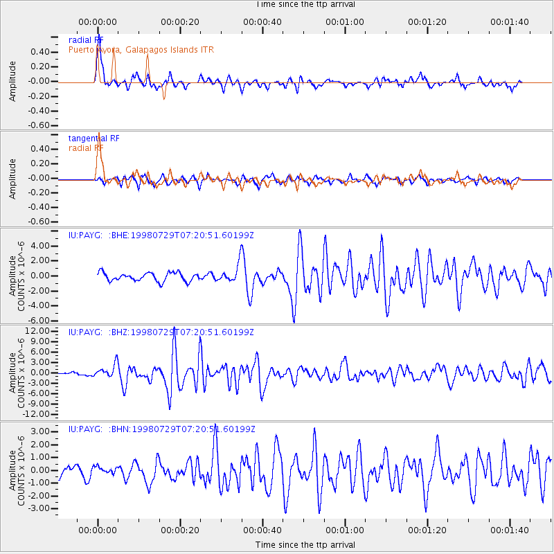
Signal To Noise
| Channel | StoN | STA | LTA |
| IU:PAYG: :BHZ:19980729T07:20:51.60199Z | 3.8317988 | 1.98395E-6 | 5.177594E-7 |
| IU:PAYG: :BHN:19980729T07:20:51.60199Z | 0.6035442 | 2.709097E-7 | 4.488648E-7 |
| IU:PAYG: :BHE:19980729T07:20:51.60199Z | 2.269354 | 1.2697748E-6 | 5.595314E-7 |
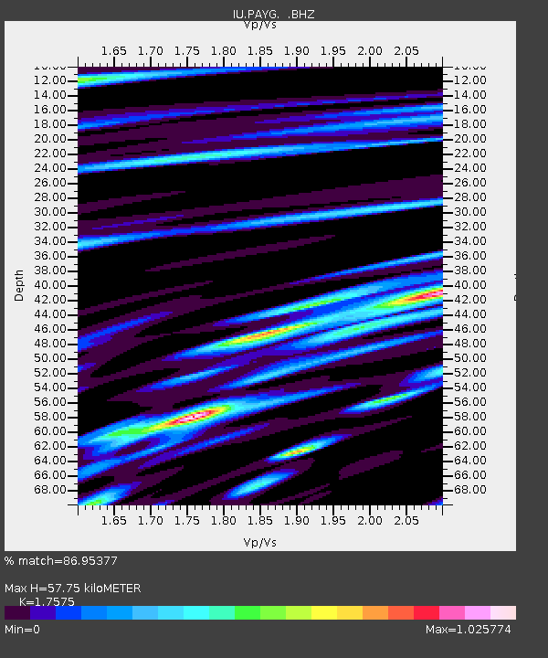
| Arrivals | |
| Ps | 9.5 SECOND |
| PpPs | 32 SECOND |
| PsPs/PpSs | 41 SECOND |

