PAYG Puerto Ayora, Galapagos Islands - Earthquake Result Viewer
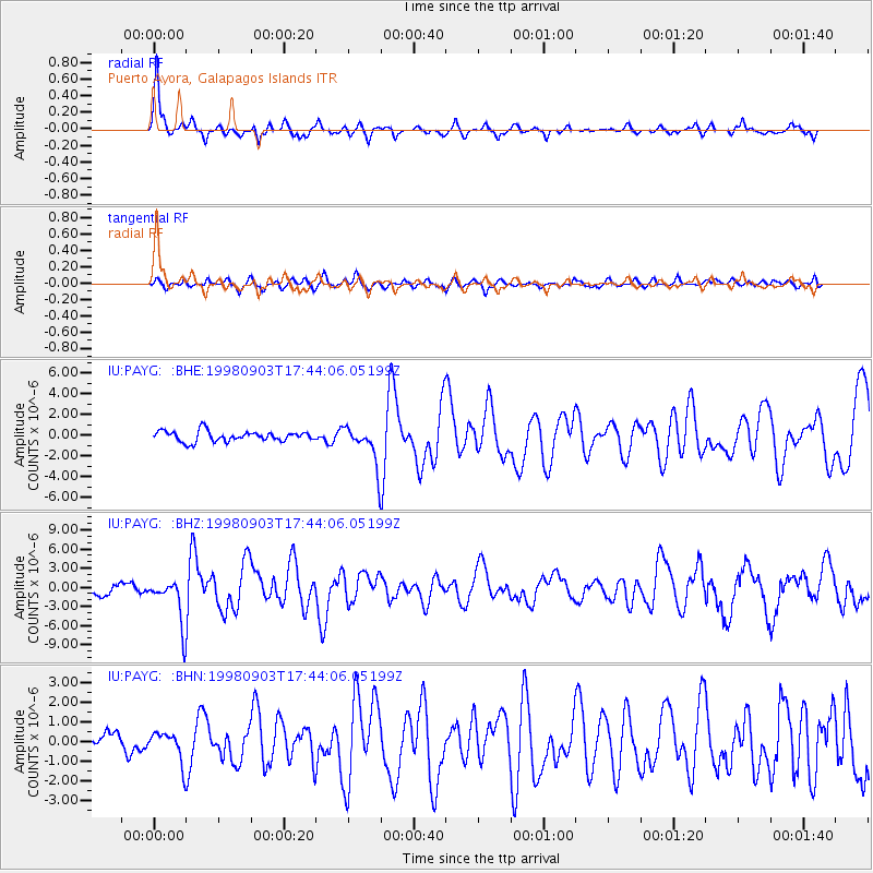
Earthquake location: Near Coast Of Central Chile
Earthquake latitude/longitude: -29.5/-71.7
Earthquake time(UTC): 1998/09/03 (246) 17:37:58 GMT
Earthquake Depth: 27 km
Earthquake Magnitude: 6.2 MB, 6.6 MS, 6.5 UNKNOWN, 6.4 ME
Earthquake Catalog/Contributor: WHDF/NEIC
Network: IU Global Seismograph Network (GSN - IRIS/USGS)
Station: PAYG Puerto Ayora, Galapagos Islands
Lat/Lon: 0.67 S/90.29 W
Elevation: 270 m
Distance: 33.7 deg
Az: 324.92 deg
Baz: 149.914 deg
Ray Param: 0.078071564
Estimated Moho Depth: 31.5 km
Estimated Crust Vp/Vs: 1.84
Assumed Crust Vp: 4.802 km/s
Estimated Crust Vs: 2.61 km/s
Estimated Crust Poisson's Ratio: 0.29
Radial Match: 86.12597 %
Radial Bump: 335
Transverse Match: 67.20591 %
Transverse Bump: 400
SOD ConfigId: 4480
Insert Time: 2010-03-02 15:45:29.719 +0000
GWidth: 2.5
Max Bumps: 400
Tol: 0.001

Signal To Noise

ChannelStoNSTALTA
IU:PAYG: :BHZ:19980903T17:44:06.05199Z2.72895033.5490752E-61.3005276E-6
IU:PAYG: :BHN:19980903T17:44:06.05199Z1.36459277.728738E-75.663769E-7
IU:PAYG: :BHE:19980903T17:44:06.05199Z3.71536851.8463892E-64.969599E-7
Arrivals
Ps5.7 SECOND
PpPs18 SECOND
PsPs/PpSs24 SECOND