XMAS Kiritimati Island, Republic of Kiribati - Earthquake Result Viewer
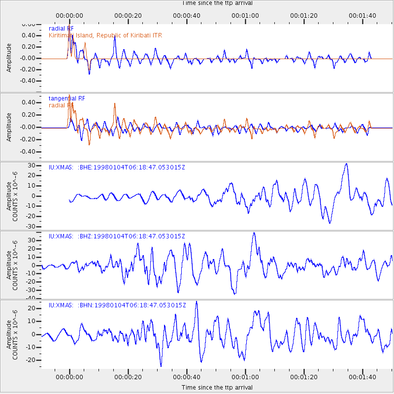
Earthquake location: Southeast Of Loyalty Islands
Earthquake latitude/longitude: -22.3/170.9
Earthquake time(UTC): 1998/01/04 (004) 06:11:58 GMT
Earthquake Depth: 101 km
Earthquake Magnitude: 6.4 MB, 7.4 UNKNOWN, 7.3 ME
Earthquake Catalog/Contributor: WHDF/NEIC
Network: IU Global Seismograph Network (GSN - IRIS/USGS)
Station: XMAS Kiritimati Island, Republic of Kiribati
Lat/Lon: 2.04 N/157.45 W
Elevation: 2.0 m
Distance: 39.2 deg
Az: 55.987 deg
Baz: 230.186 deg
Ray Param: 0.07476402
Estimated Moho Depth: 26.75 km
Estimated Crust Vp/Vs: 1.91
Assumed Crust Vp: 4.802 km/s
Estimated Crust Vs: 2.514 km/s
Estimated Crust Poisson's Ratio: 0.31
Radial Match: 85.86177 %
Radial Bump: 368
Transverse Match: 70.146965 %
Transverse Bump: 400
SOD ConfigId: 4480
Insert Time: 2010-03-02 15:45:38.819 +0000
GWidth: 2.5
Max Bumps: 400
Tol: 0.001

Signal To Noise

ChannelStoNSTALTA
IU:XMAS: :BHZ:19980104T06:18:47.053015Z1.29171474.055396E-63.1395448E-6
IU:XMAS: :BHN:19980104T06:18:47.053015Z2.02697354.6590817E-62.2985407E-6
IU:XMAS: :BHE:19980104T06:18:47.053015Z1.03151932.2241825E-62.15622E-6
Arrivals
Ps5.3 SECOND
PpPs16 SECOND
PsPs/PpSs21 SECOND