XMAS Kiritimati Island, Republic of Kiribati - Earthquake Result Viewer
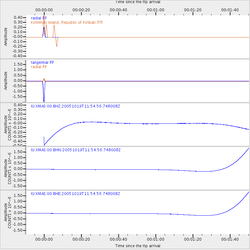
Earthquake location: Near East Coast Of Honshu, Japan
Earthquake latitude/longitude: 36.4/140.8
Earthquake time(UTC): 2005/10/19 (292) 11:44:42 GMT
Earthquake Depth: 32 km
Earthquake Magnitude: 6.2 MB, 6.5 MS, 6.4 MW, 6.3 MW
Earthquake Catalog/Contributor: WHDF/NEIC
Network: IU Global Seismograph Network (GSN - IRIS/USGS)
Station: XMAS Kiritimati Island, Republic of Kiribati
Lat/Lon: 2.04 N/157.45 W
Elevation: 2.0 m
Distance: 66.2 deg
Az: 105.933 deg
Baz: 309.083 deg
Ray Param: 0.057698913
Estimated Moho Depth: 10.0 km
Estimated Crust Vp/Vs: 1.60
Assumed Crust Vp: 4.802 km/s
Estimated Crust Vs: 3.001 km/s
Estimated Crust Poisson's Ratio: 0.18
Radial Match: 99.999985 %
Radial Bump: 2
Transverse Match: 100.0 %
Transverse Bump: 2
SOD ConfigId: 2564
Insert Time: 2010-03-02 15:45:57.641 +0000
GWidth: 2.5
Max Bumps: 400
Tol: 0.001

Signal To Noise

ChannelStoNSTALTA
IU:XMAS:00:BHN:20051019T11:54:56.748008Z0.913346471.3992589E-71.5320131E-7
IU:XMAS:00:BHE:20051019T11:54:56.748008Z0.91330031.3987058E-71.5314852E-7
IU:XMAS:00:BHZ:20051019T11:54:56.748008Z0.91345141.3937293E-71.5257838E-7
Arrivals
Ps1.3 SECOND
PpPs5.3 SECOND
PsPs/PpSs6.6 SECOND