You are here: Home > Network List > TA - USArray Transportable Network (new EarthScope stations) Stations List
> Station Z41A Richland Creek Farm, El Dorado, AR, USA > Earthquake Result Viewer
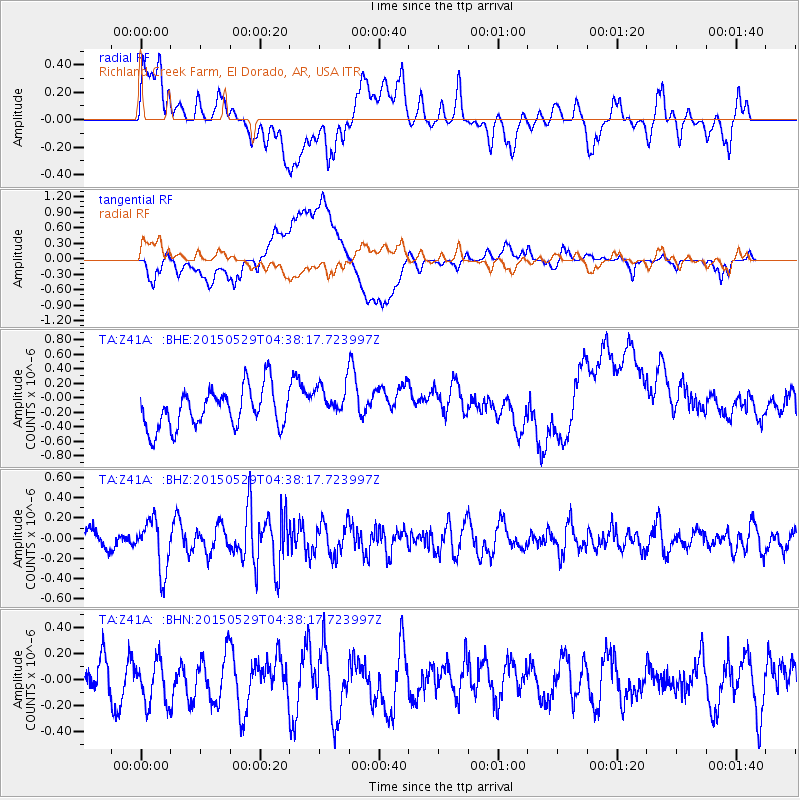
Z41A Richland Creek Farm, El Dorado, AR, USA - Earthquake Result Viewer
*The percent match for this event was below the threshold and hence no stack was calculated.
| Earthquake location: |
Central Chile |
| Earthquake latitude/longitude: |
-28.2/-70.8 |
| Earthquake time(UTC): |
2015/05/29 (149) 04:28:16 GMT |
| Earthquake Depth: |
49 km |
| Earthquake Magnitude: |
5.2 MW, 5.2 mb, 4.6 MS |
| Earthquake Catalog/Contributor: |
ISC/ISC |
|
| Network: |
TA USArray Transportable Network (new EarthScope stations) |
| Station: |
Z41A Richland Creek Farm, El Dorado, AR, USA |
| Lat/Lon: |
33.26 N/92.80 W |
| Elevation: |
62 m |
|
| Distance: |
64.6 deg |
| Az: |
339.691 deg |
| Baz: |
158.551 deg |
| Ray Param: |
$rayparam |
*The percent match for this event was below the threshold and hence was not used in the summary stack. |
|
| Radial Match: |
48.340477 % |
| Radial Bump: |
400 |
| Transverse Match: |
41.286858 % |
| Transverse Bump: |
400 |
| SOD ConfigId: |
7422571 |
| Insert Time: |
2019-04-19 02:30:38.735 +0000 |
| GWidth: |
2.5 |
| Max Bumps: |
400 |
| Tol: |
0.001 |
|
Signal To Noise
| Channel | StoN | STA | LTA |
| TA:Z41A: :BHZ:20150529T04:38:17.723997Z | 3.1245859 | 2.5134096E-7 | 8.043977E-8 |
| TA:Z41A: :BHN:20150529T04:38:17.723997Z | 1.3249893 | 1.7440009E-7 | 1.3162376E-7 |
| TA:Z41A: :BHE:20150529T04:38:17.723997Z | 0.9046406 | 2.4773527E-7 | 2.738494E-7 |
| Arrivals |
| Ps | |
| PpPs | |
| PsPs/PpSs | |


